Shira Route Kilimanjaro Climb: Day-by-Day Itinerary for the High-Altitude Western Approach
Shira Route Kilimanjaro climb—a high-starting, scenic path to Uhuru Peak (5,895m/19,341ft). This lesser-traveled route skips the lower rainforest for immediate plateau views, offering excellent acclimatization despite its quick elevation gain. If you’re planning a Kilimanjaro Shira Route adventure, including a Shira Route map or Shira Plateau Route Kilimanjaro details, this guide provides everything for a successful trek from Arusha.
The Shira Route Kilimanjaro covers about 56km (35 miles) over 6-7 days, with success rates of 80-85% on the longer version. Starting at 3,414m, it’s ideal for experienced hikers but demands pre-acclimatization. For Arusha-based operators and bookings, connect with Mount Kilimanjaro Guide.
Why Choose the Shira Route for Your Kilimanjaro Climb?
The Shira Route climb stands out for:
- High-Altitude Start: Drive to Morum Barrier (3,414m) for a shorter trek, bypassing humid forests—great for Arusha climbers avoiding extra days.
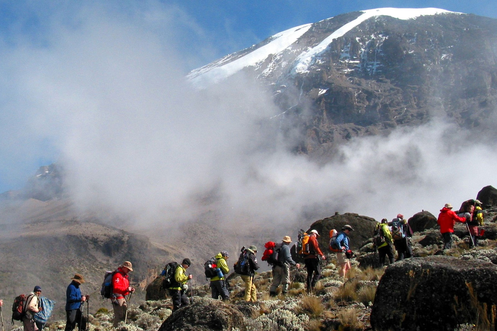
- Stunning Plateau Scenery: Expansive Shira Plateau views, giant groundsels, and Kibo Peak panoramas from Day 1.
- Good Acclimatization: “Climb high, sleep low” profile after joining Lemosho/Machame paths, reducing sickness risks.
- Fewer Crowds: Remote western entry means quieter trails than Machame.
- Success Rate: 80-85% on 7 days, with camping throughout and descent via Mweka.
- Moderate-high difficulty; prepare for rapid altitude. For a Kilimanjaro Shira Route map and custom plans from Arusha, visit Mount Kilimanjaro Guide.
Detailed Shira Route Itinerary: 7 Days (Recommended for Better Success)
The 7-day Shira Route Kilimanjaro climb includes an acclimatization day. Drive from Arusha (2-3 hours) to the gate. Here’s a standard itinerary:
| Day | Stage | Elevation Start/End | Distance | Time | Highlights |
|---|
| 1 | Morum Barrier to Shira 1 Camp | 3,414m (11,200ft) to 3,505m (11,500ft) | 3km (2mi) | 1-2 hrs | Short hike across plateau; first Kibo views; camp on moorland. |
| 2 | Shira 1 to Shira 2 Camp | 3,505m (11,500ft) to 3,840m (12,600ft) | 7km (4mi) | 3-4 hrs | Traverse Shira Plateau; acclimatization walks; sunset vistas. |
| 3 | Shira 2 to Lava Tower to Barranco Camp | 3,840m (12,600ft) to 4,630m (15,190ft) to 3,976m (13,044ft) | 10km (6mi) | 6-8 hrs | High point at Lava Tower; descend to scenic valley with groundsels. |
| 4 | Barranco Camp to Karanga Camp | 3,976m (13,044ft) to 3,995m (13,106ft) | 5km (3mi) | 4-5 hrs | Scramble Barranco Wall; short day for recovery. |
| 5 | Karanga Camp to Barafu Camp | 3,995m (13,106ft) to 4,673m (15,331ft) | 4km (2mi) | 3-4 hrs | Alpine desert; rest for summit push. |
| 6 | Barafu Camp to Uhuru Peak to Mweka Camp | 4,673m (15,331ft) to 5,895m (19,341ft) to 3,068m (10,065ft) | 17km (11mi) | 10-15 hrs | Midnight ascent; summit glory; descend. |
| 7 | Mweka Camp to Mweka Gate | 3,068m (10,065ft) to 1,640m (5,380ft) | 10km (6mi) | 3-4 hrs | Forest trail; certificates; return to Arusha. |
Pace slowly (“pole pole”). For a 6-day Shira Route itinerary, skip Day 4’s short leg, but success drops to ~70%.
Preparation Tips for Your Shira Plateau Route Kilimanjaro Climb
- Fitness: Train 4-6 months with Arusha hikes; high start means pre-acclimatize at lower altitudes.
- Gear: Layers for cold, -10°C bag, poles; rent in Arusha.
- Health: Diamox recommended; hydrate 4L/day; Arusha check-up.
- Best Time: January-March or June-October from Arusha.
- Costs: $2,000-$3,500 from Arusha, including fees, crew.
- For a Shira Route map and ethical Arusha teams, check Mount Kilimanjaro Guide.
Key Facts: Kilimanjaro Shira Route
- Distance: 56km round trip.
- Success Rate: 80-85% on 7 days.
- Unique: High drive-in start for quicker access.
FAQs: Shira Route Kilimanjaro Climb
What’s the Shira Route Kilimanjaro climb like? High-altitude western start with plateau views, joining southern paths.
Is the Kilimanjaro Shira Route good for beginners? Experienced hikers preferred due to rapid elevation; acclimatize first.
Where can I find a Shira Route map? At Mount Kilimanjaro Guide.
How long is the Shira Plateau Route Kilimanjaro? 56km, 6-7 days.
Plan your Shira Route Kilimanjaro climb with Mount Kilimanjaro Guide and reach the top of Mount Kilimanjaro!
 {
Skip to content
{
Skip to content