... {

Mount Kilimanjaro Guide - Private & Luxury Kilimanjaro Climbs with Local Guides

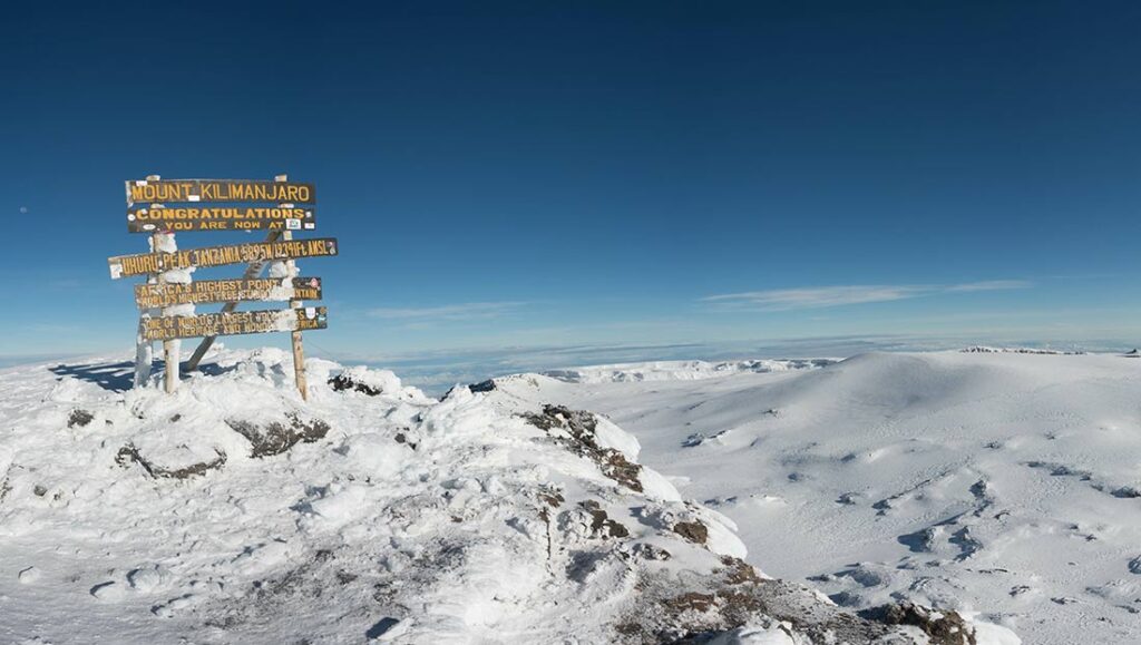
Mount Kilimanjaro Guide: Information On How To Plan A Trip To Mount Kilimanjaro

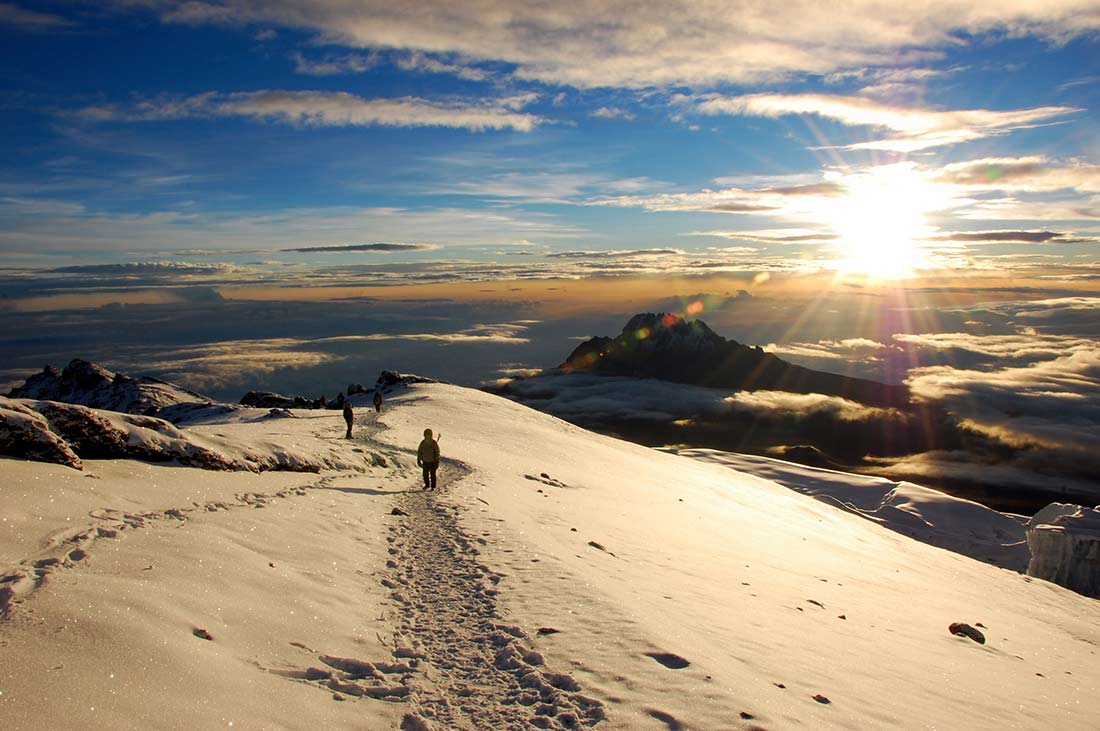
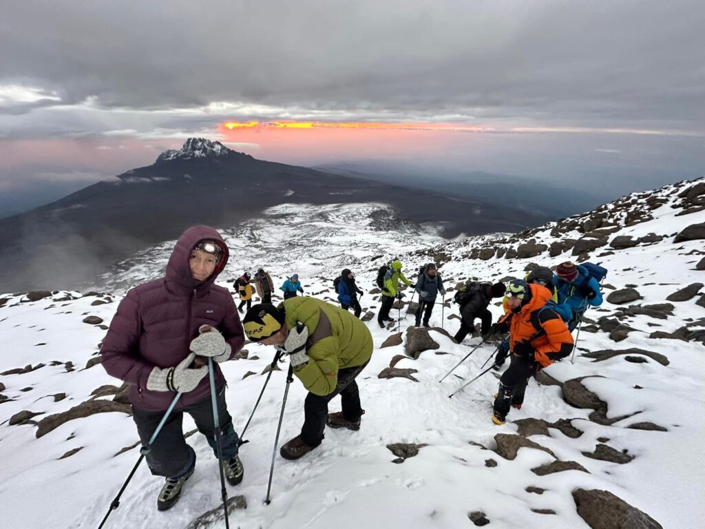
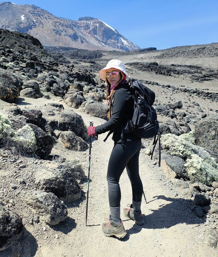
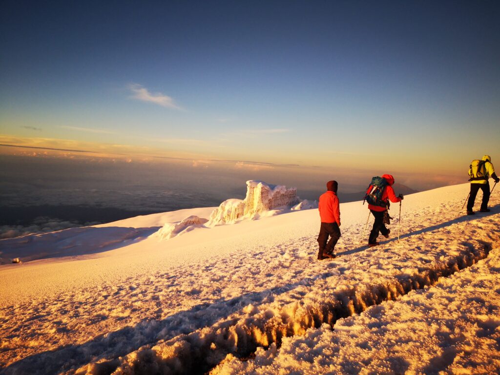
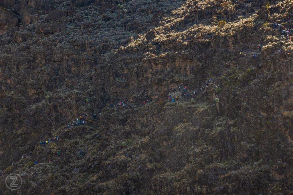
So you probably have a lot of questions, like "When is the best time to climb Kilimanjaro" "Which route should I choose?" How difficult is Kilimanjaro? " "How long does it take to climb Mount Kilimanjaro "What are the routes on Kilimanjaro and how do I choose one? Mount Kilimanjaro trekking offers some of the most diverse scenery in the world. One of the most appealing aspects of climbing Kilimanjaro in Tanzania is that it does not require technical mountaineering skills. However, it does demand strong determination, mental resilience, and physical preparation. If you are committed to the challenge, you are already on the right path—landing on this page is the perfect place to begin planning your Kilimanjaro expedition.
tripadvisor logoMount Kilimanjaro GuideMount Kilimanjaro Guide
4.9 tripadvisor stars
4.9 Stars - Based on 2851 User Reviews

Request Your Private Kilimanjaro Itinerary – Get a Personalized Quote in 24 Hours!

Homepage Quick Quote Form

Mount Kilimanjaro Guide: Routes, Costs, Success Rates & Best Time to Climb

If you are planning to climb Mount Kilimanjaro, this Mount Kilimanjaro Guide explains everything you need to know: routes, cost, preparation, success rates, and how to choose the right Kilimanjaro local guide.

Unlike technical mountains like Everest, Mount Kilimanjaro is a trekking peak. It does not require rock climbing skills, but it demands strong determination, mental resilience, and physical preparation. The Mount Kilimanjaro Guide is designed to take you from a beginner asking “When is the best time to climb Kilimanjaro” to a summit success story at Uhuru Peak (5,895m).

Can you climb Mount Kilimanjaro without a guide?
No. Tanzanian law mandates that all climbers must be accompanied by a licensed guide. Solo climbing is strictly prohibited to ensure safety, environmental protection, and proper management of the mountain.

Who Can Climb Kilimanjaro? Anyone from children over the age of 10 to older generations in their 60s and 70s! All you need is determination and the will to get to the summit. The real challenge with climbing Kilimanjaro is the altitude and the rate of ascent. Don’t worry we will be with you every step of the way!

 
mount kilimanjaro guide

A Beginner’s Guide to Climbing Mount Kilimanjaro

The Mount Kilimanjaro guide  covers everything from route selection (7 official routes), costs, best climbing months (January–March & June–October), altitude (19,341 ft / 5,895 m), success rates (65%–90%), and acclimatization tips. recommends the Lemosho Route (8-9 days) as the most successful route with a 90%+ summit rate. The average cost ranges from 2,000–6,000 USD depending on the route, operator, and group size. You do NOT need technical climbing experience — anyone with moderate fitness can summit. The best months to climb are January–March and June–October.
 

Best Time to Climb Mount Kilimanjaro (Weather, Seasons & Monthly Guide)

The best time to climb Mount Kilimanjaro is during the dry seasons from January to March and June to October, when weather conditions are more stable, skies are clearer, and trails are safer for trekking. These months offer the highest summit success rates and better visibility. While Kilimanjaro can be climbed year-round, the rainy seasons in April, May, and November bring wetter and more challenging conditions.


Why the Dry Season Is the Best Time to Climb Kilimanjaro

Climbing Mount Kilimanjaro during the dry season provides safer and more comfortable trekking conditions. Rainfall is low, trails are less slippery, and visibility is much better. Daytime temperatures at lower elevations average 21°C to 27°C (70°F – 80°F), while summit temperatures can drop below freezing.

As climbers ascend through Kilimanjaro National Park, temperatures decrease significantly, making layered clothing and cold-weather gear essential for summit night.


Mount Kilimanjaro Weather by Month

MonthWeather ConditionsClimbing Conditions
JanuaryWarm and mostly dryExcellent climbing
FebruaryWarm with clear skiesExcellent climbing
MarchIncreasing rainfallFair conditions
AprilHeavy rainNot recommended
MayEnd of rainy seasonDifficult trekking
JuneDry season beginsGood climbing
JulyCool and dryPeak climbing season
AugustDry with clear viewsExcellent conditions
SeptemberDry and slightly warmerExcellent climbing
OctoberEnd of dry seasonGood conditions
NovemberShort rainsLimited trekking
DecemberDry period beginsVery good climbing

Choose the Best Kilimanjaro Climbing Routes for Your Summit Attempt

There are several established routes to climb Mount Kilimanjaro, each varying in duration, scenery, difficulty, and summit success rate. Routes with more days generally provide better acclimatization, which significantly increases the chances of reaching Uhuru Peak (5,895m) safely. The LemoshoMachame, and Northern Circuit routes are widely regarded as the best options due to their gradual ascent profiles and higher success rates, while the Marangu and Rongai routes remain popular for their unique features such as hut accommodation and drier northern conditions.

Choosing the wrong route can mean the difference between standing on the roof of Africa and turning back at 5,000m with altitude sickness. This guide breaks down every Kilimanjaro route so you can pick the one that matches your goals, fitness level, and timeline.


1. Northern Circuit — The Highest Success Rate 

The Northern Circuit is the longest and least-traveled Kilimanjaro route, and it delivers the highest summit success rate of any route — 95–98%. If reaching Uhuru Peak is your absolute #1 priority, this is the route to choose.

  
Duration8–9 days (longest)
DifficultyModerate — gradual but long
Success Rate95–98% 
Why so high?Full circumnavigation of the mountain. Maximum acclimatization time. Rarely visited = quiet, remote experience.
Best forFirst-timers who want the highest possible summit chance
DrawbackLongest commitment; hardest to book

Why the Northern Circuit is unbeatable:

  • Full circumnavigation of Kilimanjaro — you see it from every angle
  • Maximum acclimatization time — 9 days is the gold standard
  • Virtually no crowds — you’ll have sections entirely to yourself
  • Passes through the remote northern crater rim — few climbers ever see this

Note: This route is the hardest to book and the most expensive. But if you want the best possible chance of summiting, nothing beats the Northern Circuit.


2. Lemosho —The #1 Choice for Most Climbers

The Lemosho route is widely considered the best overall Kilimanjaro climbing route for good reason. It offers the perfect balance of high summit success rate, breathtaking scenery, manageable crowds, and excellent acclimatization.

  
Duration7–8 days (sweet spot)
DifficultyModerate — gentle daily elevation gain (~598m/day avg)
Success Rate85–90% 
Why so high?Starts at ~2,100m, climbs through 5 climate zones. Excellent “climb high, sleep low” profile. Shortest push from Barafu Camp to summit (~1 hour saved).
Best forBest overall route — balances success, scenery & crowds
DrawbackSlightly longer/more expensive than Machame

Why Lemosho is the best route:

  • Starts at the lowest elevation of any route = best acclimatization
  • Passes through 5 climate zones in just 7–8 days
  • Merges with Machame on Day 3, so you get double the scenery
  • Very few crowds — feels like a private expedition
  • Gradual daily elevation gain (~600m/day average)

Pro Tip: The 8-day Lemosho itinerary is significantly better than the 7-day version. The extra acclimatization day can boost your summit success rate by 10–15%.


3. Machame (7-Day) — The Most Popular & Scenic 

The Machame route, nicknamed the “Whiskey Route”, is the most popular Kilimanjaro climbing route in the world — about 45% of all climbers choose it. The 7-day version delivers excellent success rates and some of the most dramatic scenery on the mountain.

  
Duration6–7 days (7-day version strongly preferred)
DifficultyModerate — famous Barranco Wall section
Success Rate80–85% (7-day) / 60–65% (6-day)
Why popular?Most scenic route — 5 climate zones in one trek. “Whiskey” nickname from Machame → Whiskey.
Best forThose who want iconic scenery + good success odds
DrawbackMost crowded route (~45% of all climbers). 6-day version has notably lower success.

Why Machame is so popular:

  • The famous Barranco Wall — one of the most iconic sections on Kilimanjaro
  • Passes through 5 climate zones in 7 days
  • Excellent “climb high, sleep low” profile
  • Shorter than Lemosho (7 vs 8 days) but still great acclimatization

Key Insight: The 7-day Machame has a ~20% higher success rate than the 6-day version. Always choose 7 days if you can.


4. Rongai — Best for Rainy Season & Beginners 

The Rongai route is the driest Kilimanjaro route, making it the best choice during the rainy season (November–May). It has no Barranco Wall, a gentler climb, and far fewer crowds.

Best for: Rainy season climbs, first-timers, those who want a less technical route.

  
Duration6–7 days
DifficultyEasy — gentlest gradient of all routes
Success Rate70–90% (6-day: ~70% / 7-day: ~85–90%)
Why unique?Only route from the north (Kenya side). Drier conditions — best option during rainy season. No Barranco Wall.
Best forRainy season climbs, beginners, those wanting fewer crowds
DrawbackLess dramatic scenery than Lemosho/Machame

5. Shira — “Lemosho Lite”

The Shira route starts at a much higher elevation than Lemosho, so it saves 1–2 days but sacrifices some acclimatization. It merges with the Lemosho route after Day 1–2.

Best for: Climbers short on time who still want decent success odds.

  
Duration6–8 days
DifficultyModerate
Success Rate~80%
Key traitHighest starting elevation (~3,600m) = less acclimatization time than Lemosho. Merges with Lemosho route after Day 1–2.
Best forThose short on time who still want decent success odds

6. Marangu — The Only Route with Huts 

Marangu is the only Kilimanjaro route with huts (Mandara, Horombo, Kibo huts) instead of camping. It’s comfortable but the 5-day version has the lowest success rate of any major route due to poor acclimatization.

  
Duration5–6 days (shortest with huts)
DifficultyEasy physically — but deceptive
Success Rate50–70% (5-day: ~50–60% / 6-day: ~80–85%)
Why so low?Only route with hut accommodation (Mandara, Horombo, Kibo huts). Fast ascent = poor acclimatization. “Easy” marketing misleads climbers.
Best forBudget travelers, those who want indoor sleeping & dining
DrawbackLowest success rate of major routes. Overcrowded. Avoid the 5-day version if summit success matters.

 Surprising fact: Marangu is often called the easiest route, but its 50–65% success rate is actually worse than the “harder” Machame and Rongai routes.


7. Umbwe — “The Killer” 

The Umbwe route is the most dangerous Kilimanjaro route with the lowest success rate. It has minimal acclimatization and near-vertical sections.

Best for: Expert mountaineers ONLY. Not recommended for first-timers.

  
Duration5–6 days (shortest overall)
DifficultyHardest route — extremely steep, almost vertical
Success Rate30–50% 
Why so dangerous?Minimal acclimatization. No “climb high, sleep low.” Direct assault on the mountain.
Best forExpert mountaineers ONLY
DrawbackHighest AMS (altitude sickness) risk. Not recommended for first-timers.

MOUNT KILIMANJARO SUCCESS RATE BY ROUTE

The overall average summit success rate for Kilimanjaro is approximately 50–65%, but this varies dramatically depending on the route you choose. The key factor is acclimatization time — the longer you spend on the mountain, the higher your chances of reaching Uhuru Peak (5,895m).

RouteSuccess RateTurn-Back RateCommon Reason for Failure
Lemosho90%10%Altitude sickness
Machame85%15%Altitude sickness
Shira80%20%Knee injury / AMS
Rongai75%25%Fatigue / weather
Northern Circuit80%20%Time constraints
Marangu65%35%Poor acclimatization
Umbwe55%45%Steep terrain + altitude

COMPLETE MOUNT KILIMANJARO GUIDE : Everything You Need to Know Before Climbing Africa’s Tallest Peak

Mount Kilimanjaro is a dormant volcanic stratovolcano in Tanzania, East Africa, and the highest mountain in Africa at 19,341 feet (5,895 meters). It is also the tallest free-standing mountain in the world — meaning it is not part of any mountain range.

Located near the border with Kenya, Mount Kilimanjaro features five distinct volcanic cones: Kibo, Mawenzi, Shira, Lemosho, and Reusch. The summit point — Uhuru Peak — sits on the crater rim of Kibo, the youngest and highest cone.

PeakElevationStatus
Kibo5,895 m (19,341 ft) — Uhuru PeakDormant — last eruption ~360,000 years ago. Contains the famous crater and glaciers.
Mawenzi5,149 m (16,893 ft)Extinct — rugged, jagged, and technically challenging
Shira4,005 m (13,140 ft)Extinct — oldest of the three, largely eroded

Fun Fact: In Swahili, “Kilimanjaro” is believed to mean “shining mountain” or “mountain of greatness”. Some theories suggest it comes from “kilema kyaro” — meaning “the impossible journey.


Mount Kilimanjaro’s Five Climate Zones: From Rainforest to Arctic

One of the most extraordinary features of Kilimanjaro National Park is that a single trek takes you through five distinct climate zones, each with its own vegetation, wildlife, and weather:

ZoneAltitudeClimateWhat You’ll See
1. Cultivated Land / Bushland800–1,800 mWarm & humid (21–27°C)Coffee & banana farms, small villages, grazing livestock
2. Rainforest Zone1,800–2,800 mCool & misty (15–20°C), 2,000–3,000 mm rain/yearDense tropical forest, colobus monkeys, baboons, blue monkeys, turacos, orchids, mosses
3. Heath & Moorland Zone2,800–3,350 mCool days, freezing nights (10–15°C day / below 0°C night)Giant groundsel & giant lobelia (unique to Kilimanjaro), heather, protea bushes
4. Alpine Desert Zone3,350–5,000 mCold & dry, intense UV, near-freezingAlmost no vegetation — only lichens, moss cushions, and hardy alpine flora
5. Arctic Summit Zone5,000–5,895 mFreezing, -15°C to -25°C, half the oxygen of sea levelGlaciers, ice fields, volcanic boulders — no plant or animal life except a few lichens

 This is what makes Kilimanjaro truly unique: No other mountain on Earth offers five complete climate zones in a single hike. You walk through a tropical jungle on Day 1 and stand on an arctic glacier on Day 7.


Mount Kilimanjaro Weather & Temperature Guide for Climbers

ZoneDaytime TempNighttime TempRainfall
Base (800 m)25–30°C (77–86°F)15–20°C (59–68°F)600–900 mm/year
Rainforest (2,000 m)15–20°C (59–68°F)10–15°C (50–59°F)2,000–3,000 mm/year
Moorland (3,000 m)10–15°C (50–59°F)-5 to 5°C (23–41°F)1,000–1,500 mm/year (mostly mist)
Alpine Desert (4,500 m)5–10°C (41–50°F)-10 to -15°C (14–5°F)Very little
Summit (5,895 m)-7 to 2°C (19–36°F)-15 to -25°C (5 to -13°F)Snow & ice

At the summit, temperatures can drop to -25°C (-13°F) with wind chill. Sunscreen is essential — UV radiation at altitude is extreme.


Mount Kilimanjaro Wildlife Guide: Animals You May See

The park is home to over 140 species of mammals, including 25 species of antelope7 species of monkeys, and 24 species of bats. However, due to human activity at lower elevations, wildlife is concentrated in the rainforest and moorland zones.

AnimalWhere to Spot
Colobus Monkeys (black & white)Rainforest zone (1,800–2,800 m)
Blue MonkeysRainforest zone
BaboonsRainforest & moorland edges
BushbucksForest zone
ElephantsRare — lower forest slopes
Abbott’s StarlingMoorland zone (found almost nowhere else on Earth)
HyraxesRocky areas, all zones
LeopardsExtremely rare, mostly nocturnal

Colobus monkeys are the park’s most iconic wildlife. These black-and-white primates swing through the rainforest canopy and are a highlight for most trekkers.


Why Is Kilimanjaro The #1 Choice For Most Climbers?

ReasonExplanation
Highest success rate of any “real” mountain65%–90% vs 50%–70% for Aconcagua, Elbrus, Vinson
No technical skills neededUnlike Denali, Elbrus, or Everest — you just walk
Most affordable major summit2,500–5,000 vs 8,000+ for Denali, 40,000+ for Everest
Best scenery of any 7 Summit5 climate zones in one trek — rainforest to glaciers
No permit lottery or extreme logisticsUnlike Everest (lottery) or Vinson (Antarctica flight)
Achievable in 7–9 daysvs 2–3 weeks for Denali, 6–8 weeks for Everest

 Mount Kilimanjaro is the most accessible of the Seven Summits. Unlike Everest, it requires no ropes, no crampons, and no mountaineering experience. Any reasonably fit person can summit.


 MOUNT KILIMANJARO QUICK FACTS 

FactDetail
Elevation19,341 ft (5,895 m)
LocationKilimanjaro National Park, Tanzania
Mountain TypeDormant stratovolcano
First AscentHans Meyer & Ludwig Purtscheller (1889)
Number of Routes7 official routes
Best Time to ClimbJanuary–March, June–October
Average Duration5–9 days
Success Rate65%–90% (route dependent)
Permit Cost 70–100 USD (TANAPA fee)
Annual Climbers~50,000 (park limit)
Difficulty RatingModerate (Grade 2/4 non-technical)
Highest PointUhuru Peak (5,895 m)
Climate Zones5 (tropical → arctic)

MOUNT KILIMANJARO vs OTHER 7 SUMMIT

#MountainElevationTechnical Climbing?Summit Success RateTypical Cost (USD)Difficulty Level
1Mount Kilimanjaro 5,895 m (19,341 ft)No — Trekking only65% – 90%2,500–5,000Very Easy — No technical skills needed
2Aconcagua 6,961 m (22,838 ft)No — Trekking only50% – 70%3,000–8,000Moderate — Long trek, altitude is the main challenge
3Denali 6,190 m (20,310 ft)Some — Crevasses & cold50% – 60%8,000–15,000Hard — Extreme cold, crevasses, and technical sections
4Mount Elbrus 5,642 m (18,510 ft)Some — Glacier travel50% – 70%3,000–7,000Moderate to Hard — Glacier navigation required
5Mount Everest 8,849 m (29,032 ft)Yes — Full mountaineering2% – 4%40,000–100,000+Extremely Hard — The deadliest mountain on Earth
6Vinson Massif 4,892 m (16,050 ft)No — Trekking only80% – 90%20,000–40,000Moderate — Remote & extremely cold, but not technical
7Mount Kosciuszko 2,228 m (7,310 ft)No — Walk-up95%+500–1,500Trivial — A simple hike, no preparation needed

 Mount Kilimanjaro is widely considered the easiest of the Seven Summits to complete. It requires zero technical mountaineering skills, making it the perfect first summit for aspiring 7 Summits completers.


Mount Kilimanjaro National Park

Mount Kilimanjaro National Park is a UNESCO World Heritage Site located in northern Tanzania, approximately 300 kilometers south of the equator and near the town of Moshi. Established in 1973 and declared a World Heritage Site in 1987, the park protects Mount Kilimanjaro — Africa’s tallest peak at 5,895 meters (19,341 feet) — along with its surrounding montane forest belt above 1,820 meters.

The park covers an area of 1,688 square kilometers (652 square miles) and is managed by the Tanzania National Parks Authority (TANAPA). It is home to over 50,000 trekkers annually and is recognized as one of the Seven Natural Wonders of Africa.

Unlike most national parks, Kilimanjaro National Park is unique because it contains almost every ecosystem on Earth within a single trek — from tropical rainforest at the base to arctic ice at the summit.


Location & How to Get There

DetailInfo
CountryTanzania (Kilimanjaro Region)
Nearest CityMoshi (principal town)
Coordinates3°04′S 37°22′E
Distance from Equator~300 km south
Distance from Nairobi~225 km (140 miles) south
Distance from Arusha2–3 hours by road
Nearest AirportKilimanjaro International Airport (JRO), ~45 km west
Park HeadquartersMarangu Gate, ~41 km from Moshi

How long does it take to climb Mount Kilimanjaro?

Answer: Most routes take 5–9 days. The Machame Route takes 6–7 days, the Lemosho Route takes 7–8 days, and the Marangu Route can be done in 5–6 days. Longer routes = higher success rates due to better acclimatization.

Do I need any experience to climb Mount Kilimanjaro?

AnswerNo. Mount Kilimanjaro is a non-technical trek. You do not need climbing experience, ropes, or crampons. However, you should be in good physical condition and train for 3–6 months before attempting the climb.

How much does it cost to climb Mount Kilimanjaro?

Answer: The total cost ranges from USD 2,000 to USD 6,000+ for a 6–7 day trek. This includes park fees (70),operator fees(1,800–4,000),tips(200–600),flights(400–1,000),and gear.The Marangu Route is the cheapest option at 2,500.

What is the best route for Mount Kilimanjaro?

Answer: The Lemosho Route is the best overall route with a 90% success rate, superior scenery, and excellent acclimatization. The Machame Route is the most popular (30%+ of climbers) and offers the best balance of scenery, success rate, and cost.

Can I climb Mount Kilimanjaro without a guide?

Answer: No. All climbers must be accompanied by a licensed guide and a porter. Tanzania National Parks (TANAPA) regulations require a guide for safety and conservation reasons.

Is Mount Kilimanjaro dangerous?

Answer: Mount Kilimanjaro is moderately dangerous — not because of technical difficulty, but because of altitude. The main risks are altitude sickness (AMS), hypothermia, and falls. With proper acclimatization and a good guide, the risk is manageable. The fatality rate is approximately 1–2 per 100,000 climbers.

What is the best month to climb Mount Kilimanjaro?

Answer: The best months are January, February, March, June, July, August, September, and October. Avoid the rainy seasons: April–May (long rains) and November–December (short rains).

How cold is the summit of Mount Kilimanjaro?

Answer: The summit of Uhuru Peak (5,895 m) can reach temperatures of -15°C to -20°C (-5°F to -4°F) with wind chill making it feel even colder. You need a -20°C rated sleeping bag and full winter gear.


KILIMANJARO SUMMIT SUCCESS: EXPERT TIPS TO SUMMIT UHURU PEAK

Based on insights from 50+ expedition leaders and thousands of climber reviews, here are the proven tips to reach the top:

#TipWhy It Matters
1Break in your boots 2+ weeks beforeBlisters end 20% of treks early
2Drink 4+ liters of water dailyDehydration = altitude sickness
3Walk pole pole (slowly)Rushing = AMS = turning back
4Eat 4,000–5,000 calories/dayYour body burns 4x more at altitude
5Consider DiamoxReduces AMS risk by 50% (prescription needed)
6Sleep at the same altitude 2 nightsBetter acclimatization than climbing fast
7Mental preparation matters60% of failures are psychological
8Pack light for summit dayOnly bring: water, snacks, headlamp, warm layers
9Sunscreen SPF 50+UV at 5,895m is 2x stronger than at sea level
10Bring a power bankNo charging stations above base camp
mount kilimanjaro guide

Meet Mount Kilimanjaro Guide — Tanzania’s Most Trusted Local Tour Operator

Mount Kilimanjaro Guide is a fully licensed, locally-owned Kilimanjaro tour operator based in Moshi, Tanzania — the gateway town to Mount Kilimanjaro. We have been helping climbers from around the world reach the summit of Africa’s highest peak safely and successfully since our founding.

Our team of professional mountain guides, experienced porters, and dedicated logistics staff provide expert support on every major route, including Lemosho, Machame, Marangu, Rongai, Northern Circuit, and Shira. We don’t just get you to the top — we make sure you come back safe, happy, and proud.

 Are Kilimanjaro Guides Mandatory? — Yes, And Here’s Why

Yes, hiring a Kilimanjaro guide is mandatory for anyone climbing Mount Kilimanjaro. This is not optional. This is not a suggestion. This is the law.

The Tanzania National Parks Authority (TANAPA) requires that every climber trekking inside Kilimanjaro National Park must be accompanied by a licensed mountain guide at all times. This rule has been in place for decades and exists for very good reasons.

MOUNT KILIMANJARO GUIDE

Preparation and Training for Climbing Kilimanjaro

Success on Kilimanjaro depends on physical and mental prep. Start training 3-6 months in advance.

Preparation for Your Mount Kilimanjaro Guided Hike

Mount Kilimanjaro Guide ensures you’re ready for your Mount Kilimanjaro guided hike to Mount Kilimanjaro:

Physical Training

Train 6–8 months with cardio (running, cycling) and strength exercises (squats, lunges). Hike weekly with a 10–15 kg backpack to build endurance.

Gear Essentials

Moisture-wicking layers, waterproof jacket, trekking poles, high-traction boots. Rent -10°C sleeping bags and other gear from our Mount Kilimanjaro guide team.

Health Precautions

Drink 3–4 liters daily; guides monitor hydration and vitals twice daily. Secure travel insurance covering high-altitude trekking (up to 6,000m).

Logistics

Book flights to Kilimanjaro International Airport (JRO); transfers included. Obtain Tanzanian visa and vaccinations (e.g., yellow fever, if required).

mount kilimanjaro guide
Mount Kilimanjaro Guide

Mount Kilimanjaro Guide Cost: What to Expect

The cost of climbing Mount Kilimanjaro with a professional guide typically ranges from $2,000 to $6,000+ per person, depending on factors such as the route, trip duration, group size, and level of service provided by the tour operator. Budget packages may seem appealing at first, but they often compromise on important aspects like guide experience, food quality, safety equipment, and porter welfare. Choosing a reputable operator ensures better safety standards, experienced mountain guides, and ethical treatment of support staff.

Most mid-range and premium Kilimanjaro tours, usually priced between $2,500 and $4,000, offer higher-quality meals, reliable camping equipment, experienced climbing guides, and well-trained support teams. These operators also tend to follow responsible tourism practices and provide better overall expedition support. It is important to remember that park fees alone—charged by the Tanzania National Parks Authority for entering Kilimanjaro National Park—typically cost around $800 to $1,000 per climber, which means extremely cheap packages often reduce costs in other critical areas.

Several factors influence the total price of a Kilimanjaro climb. Park fees are the largest component and cover conservation, camping permits, and rescue services. Guide and porter wages are another essential expense, as Tanzanian regulations require all climbers to be accompanied by licensed guides and support staff to carry equipment and supplies. Tour operators also provide food, tents, cooking equipment, and other mountain logistics, which are included in most climbing packages.

In addition to the package price, climbers should budget for extra expenses such as crew tips, optional gear rental, travel insurance, and international flights to Tanzania. The route and duration of the climb also affect the final cost. Longer itineraries—typically seven to nine days—are more expensive due to higher park fees and staff wages, but they also provide better acclimatization and significantly improve summit success rates.


Mount Kilimanjaro Guide

Training for Mount Kilimanjaro: The Complete 12-Week Success Protocol

The Three Pillars of Kilimanjaro Fitness

Physical preparation is non-negotiable for summit success. While Kilimanjaro requires no technical climbing skills, the combination of daily elevation gains of 500–1,000 meters and extreme altitude of 5,895 meters demands specific conditioning.

There are three pillars you must build:

PillarWhat It MeansWhy It Matters
1.Cardiovascular EnduranceYour heart and lungs must work efficiently in thin airThis is the foundation. Without it, nothing else matters.
2. Strength & StabilityYour legs, core, and ankles must handle 12+ hours of continuous effortSummit night and the 2,795m descent will destroy weak legs and unstable ankles.
3. Altitude SimulationYour body must learn to function with less oxygenYou cannot fully simulate 5,895m at sea level, but you can prepare your body significantly.

Pillar 1: Cardiovascular Endurance (Zone 2 Training)

This is the most important pillar. Your aerobic base determines whether your body can handle the oxygen deprivation at altitude.

What Is Zone 2 Training?

Zone 2 is 60–70% of your maximum heart rate. It is the pace where you can still hold a conversation but breathing is noticeably deeper. This is the “fat-burning zone” and the zone that builds your aerobic engine.

Training MethodHow OftenDurationWhy It Works
Zone 2 Cardio (running, cycling, swimming)4–5 times per week45–90 minutes per sessionBuilds the aerobic base your lungs need at 5,000m+
StairMaster with weighted pack (10–15 kg)2–3 times per week30–60 minutesDirectly simulates uphill trekking with a pack
Hiking on trails with 500m+ elevation gain1–2 times per week3–5 hoursSpecificity — you train exactly what you will do on the mountain

Pillar 2: Strength & Stability

Kilimanjaro is not just a cardio challenge. It is a leg endurance and joint stability challenge. Summit night requires 6–8 hours of continuous uphill walking, and the descent is a brutal 2,795m of downhill impact on your knees and ankles.

Muscle GroupExercisesWhy It Matters
Quadriceps & GlutesSquats, lunges, step-ups with 10–15 kg weighted packThese muscles do 90% of the work on summit night. If they fail, you fail.
Knees (Downhill Protection)Rear-foot elevated split squats, leg pressThe descent from Uhuru Peak is 2,795m of steep, rocky downhill. Weak knees = injury = evacuation.
CorePlanks (60+ seconds), dead bugs, Russian twistsA strong core keeps you stable on uneven terrain and reduces back pain from carrying a pack.
AnklesSingle-leg balance exercises, calf raisesThe terrain above 4,500m is loose volcanic rock. Weak ankles mean twisted ankles and turn-backs.
CalvesCalf raises (weighted), stair climbingYour calves burn constantly during the summit push. Train them or they will cramp at Stella Point.

Pillar 3: Altitude Simulation

You cannot fully replicate 5,895m at sea level. But you can prepare your body to handle thin air significantly better.

MethodHow To Do ItWhy It Helps
Hypoxic Training (Altitude Chambers)Use a altitude simulation tent or mask if availableTrains your body to produce more red blood cells before you even arrive
Breathing Exercises (Pressure Breathing)Practice forceful exhalation techniques daily for 2–3 weeksMimics the breathing pattern needed at extreme altitude. Reduces breathlessness on summit night.
Sleep High, Train LowIf possible, spend weekends at elevation above 3,000mExposes your body to altitude while still allowing quality training at lower elevation
Sleep with a Training MaskWear an elevation training mask during easy runsSimulates mild altitude (2,500–3,500m) during cardio sessions

Kilimanjaro 12 Week Training Progressive Plan

PhaseWeeksFocusKey Sessions
Base Building1–4Aerobic foundation3x cardio, 2x strength, 1x long hike (3–4 hrs)
Specificity5–8Mountain simulation4x weighted hikes, stair training, pack practice
Peak9–11Intensity & enduranceBack-to-back hiking days, 6–8 hour hikes, test gear
Taper12RecoveryReduce volume 50%, maintain intensity, arrive rested
Critical Success Factor: The summit push requires 12+ hours of continuous effort (midnight start, 6–8 hours ascent, immediate descent). Your training must include back-to-back long days to simulate this fatigue

━━━━━━━━━━━━━━━━━━━━━━━━━━━━━━━━━━━━

Altitude Sickness on Kilimanjaro: Prevention & Management

Acute Mountain Sickness (AMS) is the number one reason for summit failure on Mount Kilimanjaro. Understanding how to prevent and manage it is just as important as physical training.

Understanding the Risk Zones

AltitudeZoneRisk LevelSymptoms to Watch For
2,500–3,500 mModerate AltitudeLow RiskMild headache, slight breathlessness, minor sleep disruption
3,500–5,000 mHigh AltitudeModerate RiskPersistent headache, nausea, fatigue, dizziness, loss of appetite, poor sleep
5,000–5,895 mExtreme AltitudeHigh RiskSevere AMS, HACE (High Altitude Cerebral Edema), HAPE (High Altitude Pulmonary Edema) — life-threatening
 

The “Pole Pole” Strategy — Your Best Defense Against AMS

“Pole pole” means “slowly, slowly” in Swahili. It is not just a catchy phrase — it is a physiological necessity.

Pole Pole PrincipleWhat It Means in Practice
PacingWalk at a conversational pace the entire time. If you cannot speak in full sentences, you are going too fast. Slow down immediately.
BreathingFocus on deep, rhythmic breathing. Use pressure breathing (forceful exhalation) above 4,500m. This forces more oxygen into your lungs.
Rest StepsAbove 4,500m, pause briefly with every step. Inhale deeply, exhale forcefully, then take the next step. This is not weakness — it is strategy.
HydrationDrink 4–5 liters of water daily. Dehydration makes AMS 3x worse.
Listen to Your GuideIf your guide says “slow down,” slow down. They have summited 100+ times. You have not.

Hydration Protocol — The Silent Killer of Summit Dreams

Dehydration accelerates altitude sickness dramatically. At altitude, your body loses water 3 times faster than at sea level due to rapid breathing and dry air.

Hydration RuleTargetWhy
Daily Water Intake4–5 liters minimum (not including tea/coffee)Your body needs this much just to function at 4,000m+
Don’t Wait Until You’re ThirstyDrink on a schedule — every 30 minutes on the trailBy the time you feel thirsty, you are already 2% dehydrated
Add ElectrolytesElectrolyte tablets in every liter of waterPlain water is not enough. You lose sodium, potassium, and magnesium rapidly at altitude
Warm Drinks Over ColdTea, warm water, soupWarm liquids are absorbed faster and help maintain core temperature
Avoid Alcohol & CaffeineZero alcohol. Limit caffeine after Day 2Both are diuretics — they make you lose even more water
Urine Color TestShould be pale yellow to clearDark yellow = dehydrated. Drink immediately.
 

 Medication Strategy — Diamox & When to Use It

MedicationDosageWhen to StartWhat It DoesSide Effects
Diamox (Acetazolamide)125 mg twice daily24 hours before your first ascentAccelerates acclimatization by increasing your breathing rate, which helps your body adjust to altitude fasterTingling in fingers/toes, increased urination, mild headache — all manageable
DexamethasoneEmergency use onlyOnly if severe AMS / HACE symptoms appearReduces brain swelling in HACE (High Altitude Cerebral Edema)Drowsiness, increased appetite — this is a life-saving emergency drug

 Important: Diamox is a preventive aid, not a guarantee. It helps your body acclimatize faster, but it does not replace slow pacing, hydration, and proper rest. Always consult your doctor before taking Diamox. Some people should not take it (sulfa allergy, certain heart/kidney conditions).


When to Descend: The Golden Rule of Altitude Sickness

This is the most important section of this entire guide. Read it carefully.

Immediate descent is mandatory if you experience ANY of the following:

SymptomWhat It MeansAction
Ataxia (Loss of Coordination)You cannot walk heel-to-toe in a straight line Descend immediately. This is HACE. It can kill you within hours.
Confusion / Altered Mental StateYou are irrational, disoriented, or cannot remember simple thingsDescend immediately. This is HACE. Do not wait.
Severe Breathlessness at RestYou are gasping for air while sitting stillDescend immediately. This may be HAPE (fluid in lungs). It is life-threatening.
Persistent VomitingYou cannot keep food or water down for more than 2 hours Descend. You cannot hydrate or medicate yourself. You will get worse.
Severe Headache + Nausea TogetherClassic AMS that is not improving with restDo not ascend further. Rest at current altitude. If no improvement in 4 hours, descend.

The Golden Rule“If in doubt, go down.” Never push through worsening symptoms. Descending just 500 meters can cure mild AMS within hours. The summit will always be there. Your life may not be.


Mental Preparation — The Summit Is 50% Mindset

The physical challenge is real. But the mental challenge is harder. At 2 AM on summit night, in -20°C winds, with your body screaming at you to stop — that is when the climb is truly won or lost.

Mental StrategyHow To Apply It
Break the climb into small goalsDo not think about the summit. Think about the next 100 meters. Then the next 100. Then the next.
Talk to yourself positively“I can do this.” “One more step.” “I trained for this.” Replace every negative thought instantly.
Visualize the summit every nightBefore sleep, close your eyes and see yourself standing at Uhuru Peak. Feel the wind. See the sunrise.
Accept discomfortYou will be cold, tired, nauseous, and miserable. That is normal. It does not mean you are failing. It means you are climbing.
Trust your guide completelyIf your guide says “slow down,” slow down. They have summited 100+ times. You have not. Listen to them.
Do not compare yourself to othersSome people walk faster. Some walk slower. Your pace is YOUR pace. Focus only on yourself.
Celebrate small winsReached camp? Win. Finished dinner? Win. Woke up at midnight? Win. Every single step is progress.

How Hard Is It to Climb Mount Kilimanjaro?

Climbing Mount Kilimanjaro is challenging but achievable for many people with good preparation and determination. The trek involves a vertical ascent of nearly 3 miles (about 4,900 meters) from the base to the summit. Along the way, climbers pass through five distinct climate zones, starting in warm bushland and rainforest before reaching the freezing arctic conditions near the summit. This dramatic change in environment makes Kilimanjaro one of the most unique trekking experiences in the world.

Summit day is the most demanding part of the journey. Climbers typically begin the final ascent around midnight, hiking for 6–7 hours in darkness and freezing temperatures while gaining 1,300–1,400 meters of elevation. At the summit, temperatures are usually below zero, and thin air makes every step more difficult. After reaching Uhuru Peak, trekkers must still descend to the next campsite, making summit day a 12-hour or longer challenge.

Another major factor that makes Kilimanjaro difficult is altitude sickness. As climbers ascend higher, the oxygen level decreases, which can cause headaches, fatigue, nausea, and dizziness. While many climbers experience mild symptoms, serious altitude sickness can occur and requires immediate descent to a lower altitude.


The “Pole-Pole” Rule on Kilimanjaro

One of the most important principles when climbing Mount Kilimanjaro is the famous Swahili phrase “pole-pole,” meaning “slowly, slowly.” Guides constantly remind climbers to walk at a steady, relaxed pace to help the body adjust to the altitude. Moving too quickly increases the risk of exhaustion and altitude sickness.

Your guides will also encourage you to drink plenty of water, rest regularly, and maintain a consistent trekking rhythm. Even very fit climbers may feel the effects of high altitude, so pacing yourself is the key to reaching the summit safely.

If a climber experiences severe altitude symptoms, guides may require them to descend immediately with a member of the support team. Safety always comes first, and sometimes abandoning the summit attempt is necessary to protect your health.

MOUNT KILIMANJARO GUIDE
Mount Kilimanjaro guide

Start Your Mount Kilimanjaro Adventure Today

With the ultimate Mount Kilimanjaro guide from Mount Kilimanjaro Guide, your climb to Mount Kilimanjaro is within reach. Our Mount Kilimanjaro guided tours offer a 98% success rate, KINAPA-licensed expertise, and KPAP-certified ethics. Whether you’re a beginner or experienced trekker, our Mount Kilimanjaro guided hike ensures you summit Uhuru Peak safely. Book your adventure now!

Mount Kilimanjaro Adventure Inquiry
Mount Kilimanjaro Guide

STEPS TO FOLLOW

Booking a Kilimanjaro Guide

Choose the Right Time to Visit

Consider the best time of year for your Kilimanjaro climb. The dry seasons (January to March and June to October) are generally recommended.

Select Your Climb Duration

Kilimanjaro treks vary in duration, typically 5 to 9 days. Choose a duration that suits your fitness level and preferences.

There are several routes to the summit, each with its characteristics. Research and select a route that aligns with your goals and preferences.

Group Climb or Private Climb?

Decide whether you want to join a group trek or a private climb. Group treks can be more social, while private climbs offer flexibility.

How much does the guide charge for their services?

The cost of hiring a Kilimanjaro guide can vary depending on several factors, including the route, duration of the trek, and the level of service provided.

Pay the Deposit and Confirm Your Booking

Once you’ve decided,pay the required 30% deposit to secure your spot.

Pricing and Booking with Kilimanjaro Local Guides

All our packages offer flexible hike starting dates. We can schedule a new private Mount Kilimanjaro trek to start on any day you want. On a private hike, will your group have your own private team of guides, porters and cook. Your meals will be served in a private dining tent. Please note, however, that the trails and campsites will still be shared. You will meet hikers from other groups along the way.

choose a Kilimanjaro Guide

5 Day Marangu Route

1 Hiker single

$ 2 008 p/p

2 Hikers sharing

$ 1 783 p/p

3 to 4 hikers sharing

$ 1 678 p/p

mount kilimanjaro guide

6 Day Marangu Route

1 Hiker single

$ 2 308 p/p

2 Hikers sharing

$ 2 058 p/p

3 to 4 hikers sharing

$ 1 928 p/p

Kilimanjaro hike distance and elevation

6 Day Machame Or Umbwe Route

1 Hiker single

$ 2 308 p/p

2 Hikers sharing

$ 2 058 p/p

3 to 4 hikers sharing

$ 1 928 p/p

Umbwe Route

7 Day Machame Or Umbwe Route

1 Hiker single

$ 2 608 p/p

2 Hikers sharing

$ 2 348 p/p

3 to 4 hikers sharing

$ 2 203 p/p

lemosho route

6 Day Shira, Lemosho Or Rongai Route

1 Hiker single

$ 2 648 p/p

2 Hikers sharing

$ 2 243 p/p

3 to 4 hikers sharing

$ 2 063 p/p

Kilimanjaro-Rongai route

7 Day Shira, Lemosho Or Rongai Route

1 Hiker single

$ 2 938 p/p

2 Hikers sharing

$ 2 513 p/p

3 to 4 hikers sharing

$ 2 313 p/p

mount kilimanjaro Shira Route

8 Day Shira, Lemosho Or Rongai Route

1 Hiker single

$ 3 228 p/p

2 Hikers sharing

$ 2 773 p/p

3 to 4 hikers sharing

$ 2 568 p/p

Northern Circuit Route

8 Day Northern Circuit Include Toilet Rental

1 Hiker single

$ 3 588 p/p

2 Hikers sharing

$ 2 938 p/p

3 to 4 hikers sharing

$ 2 668 p/p

Kilimanjaro Northern Circuit Route

9 Day Northern Circuit Route Include Toilet Rental

1 Hiker single

$ 3 918 p/p

2 Hikers sharing

$ 3 228 p/p

3 to 4 hikers sharing

$ 2683p/p

The cost of Private Kilimanjaro trek include the following:

Before the Trek:

  • 2 nights shared hotel accommodation in Moshi town (or Marangu) on bed and breakfast basis.
  • Hotel / Lodge include safe storage facilities for excess luggage during hikes.
  • Return transfer between the hotel to the start / finish point of a climb.
  • Our exclusive, printable 15 page altitude sickness survival guide
  • A comprehensive Travel Information pack
  • Transfers between JRO airport and the hotel.

During the Trek:

  • All Park fees, camping / hut fees and climbing permits
  • Kilimanjaro National Park rescue team fees
  • Trained and certified English speaking mountain guides.
  • Chief guide carries a pulse Oximeter and do health check twice a daily while on the mountain.
  • 1 Emergency oxygen set per group send on all hikes (for use in emergencies only – not as summiting aid).
  • 1 Medical First Aid kit per group send on all hikes (for use in emergencies only)
  • Salaries for guides, cooks, waiters and porters paid as per KPAP recommendations.
  • Breakfast, lunch and dinner, as well as hot drinks on the mountain.
  • 3 litres of mineral water supplied to all hikers on day 1 of the hike.
  • Boiled drinking water from night 1 onwards while on the mountain.
  • Quality camping equipment (four season tents, sleeping mats, camp chairs, camp table, mess tent & cutlery for meals) – not applicable on the Marangu route as A-frame huts are fitted with sleeping mats and meals are served in communal dining halls.
  • Porter to carry your duffel bag, with maximum weight of 15kg / 32 lbs, from one camp to the next camp.
  • Water for washing up, supplied every morning and evening while on the mountain.
  • Certificate for your successful summit attempt
  • Private hike at no additional charge, irrespective of the group size!
Climbing Kilimanjaro in February

What’s Excluded in the Cost:

  • Flights and airport taxes
  • Items of a personal nature
  • Compulsory tips for guides, porters and cook (average tip from US$200 to US$ 350 per hiker)
  • Entry visa for Tanzania
  • Vaccination requirements (Yellow Fever – only compulsory if you travel via a Yellow Fever infected country)
  • Compulsory travel and medical insurance.
  • Personal gear – it is possible to rent some of the gear
  • Optional, but highly recommended portable toilet (not allowed on the Marangu route) (All Northern circuit route hikes include the portable toilet rental).
  • Snacks, personal medicine and sports drink
  • Meals and drinks not specified

Mount Kilimanjaro Equipment and Clothing

Without the correct equipment a mountain tour can quickly become an ordeal, this is especially true on Kilimanjaro. At the park entrance, the weather is tropical and at the summit it is a chilly -10°C and below. The onion system is the way to go, by wearing many layers you can add or remove items depending upon personal preference and is ideal for the changing climatic conditions.

A warm sleeping bag is essential, especially on camping tours. If you are thinking about using the one that you had as a child on summer camp, please think again. You will be sleeping in temperatures in the region of -12°C and you will need a sleeping bag that will keep you warm in such conditions

For yourself, you will only need a day pack; your porter will carry any further luggage. All your equipment must go in a travel bag, trekking rucksack or a kit bag and not exceed 12 kg (27lbs). The porters cannot carry suitcases and cases with roll systems. We recommend packing the items in plastic bags to protect them from the damp and rain. Please also check the baggage terms of your respective airline.

mount kilimanjaro guide

Kilimanjaro Packing List – What to take

  • Quality 3/4 season sleeping bag
  • Walking boots plus training shoes for around camp (it is advised that your walking boots are broken in before undertaking any sort of trek)
  • A walking stick/pole (this can be hired)
  • Head torch and spare batteries – important for your summit climb
  • A pair of warm trousers
  • Light cotton trousers and shorts
  • Summer shirts; long sleeves are 
    necessary as well as short sleeves, in case you get sunburnt and have to cover up your arms
  • A fleece and Gore-Tex jacket
  • Skiing underwear or thermal ‘long johns’ and top
  • A good waterproof anorak
  • Gloves and scarf
  • Plenty of socks, cotton, thick and thin
  • Sunhat and beanie (warm hat)
  • Sun goggles or glasses
  • Lip sun cream
  • A good high factor sun block for protection against the sun
  • Camera and plenty of film
  • Binoculars
  • A good quality torch and batteries
  • Basic first aid kit (plasters; lint; cotton wool; elastic bandage; antiseptic liquid or cream; blister kit; throat lozenges)
  • Personal medicines, clearly labelled
  • Gel activated hand warmers
  • High energy bars
  • Salt tablets
  • Plastic bags
  • A towel and wash bag
  • Toilet paper
  • Large water bottle, for drinking on the
  • trek (two x 2 litres)
  • Large rucksacks are not necessary but a small shoulder bag or backpack for carrying your camera, water bottle etc, is essential 

What to pack in your day pack

  • Waterproofs
  • Camera/video
  • Water bottles (bottled water can be provided at the trail head, but if you want to you can always fill up at the lodge)
  • Poncho/umbrella (dependant on season)
  • Hat
  • Sunglasses
  • Extra snacks if you have them
  • First aid kit

NOTE: on all days try to keep your day sack as light as possible. Your porters have been hired to carry most of your gear and carrying extra gear will only make you more tired and stress your body out more, making it harder for your body to deal with the altitude.

mount kilimanjaro guide

Availability

Kilimanjaro Hike starting dates

All of our climb Kilimanjaro packages are very flexible! We will gladly schedule a new hike to suit your calendar preference. Opting for a private hike ensures the privacy of your climb.

Do You Need Oxygen to Climb Kilimanjaro?

  • No Supplemental Oxygen Required: Climbers do not need supplemental oxygen to reach the summit of Kilimanjaro. The key to success is proper acclimatization.

  • Acclimatization Strategy: The “pole pole” (slowly, slowly) approach, combined with the “climb high, sleep low” method, helps your body adapt to the decreasing oxygen levels as you ascend.

  • Hydration and Rest: Staying hydrated, eating well, and getting enough rest are critical to helping your body cope with the altitude.

  • Medical Consultation: Always consult your doctor before attempting the climb to ensure you’re physically fit for high-altitude trekking.

Can You Breathe at the Summit of Kilimanjaro?

  • Thin Air at the Summit: At 5,895 meters (19,341 feet), the air contains about half the oxygen found at sea level. This makes breathing more difficult and can lead to symptoms like shortness of breath, fatigue, and headaches.

  • Acclimatization is Key: Proper acclimatization helps your body adjust to the lower oxygen levels, making it possible to breathe and function at the summit.

  • Supplemental Oxygen: While not typically required, some climbers may carry supplemental oxygen for emergencies or personal comfort.

Failure Rate of Climbing Mount Kilimanjaro

  • Summit Success Rates: The overall success rate for reaching the summit is between 45% and 65%. This varies based on:

    • Route Choice: Longer routes (e.g., Lemosho, Machame) have higher success rates due to better acclimatization.

    • Climber Preparation: Physical fitness, mental readiness, and proper gear play a significant role.

    • Guided Support: Working with experienced guides and porters increases your chances of success.

  • Recommended Itineraries: Opt for a 7-9 day climb to maximize acclimatization and improve your chances of summiting.

The Difficulty of Climbing Mount Kilimanjaro

  • Extreme Altitude: Kilimanjaro is a high-altitude trek, and altitude sickness affects more than 50% of climbers. Symptoms can range from mild headaches to life-threatening conditions like HAPE (High Altitude Pulmonary Edema) or HACE (High Altitude Cerebral Edema).

  • Physical Demands: The climb involves hiking through diverse terrains, including rainforests, rocky paths, and steep inclines. A good level of physical fitness and endurance is essential.

  • Weather Conditions: Temperatures can range from hot at the base to freezing at the summit, with unpredictable weather changes.

The Challenges of Climbing Mount Kilimanjaro

  • Summit Night: The most challenging part of the climb is summit night. This involves:

    • A steep, grueling ascent in the dark (usually starting around midnight).

    • Extremely cold temperatures and high winds.

    • Physical exhaustion and the mental challenge of pushing through fatigue.

  • Mental Strength: Climbers must be mentally prepared for the physical and emotional demands of summit night.

  • Weather: Conditions can be harsh, with snow, ice, and strong winds adding to the difficulty.

mount kilimanjaro guide

Evacuation on Mount Kilimanjaro

Evacuation on Mount Kilimanjaro is a critical safety measure for climbers who become ill, injured, or unable to continue due to altitude sickness or other health issues. The mountain’s high altitude and remote location make evacuation challenging, but there are three primary methods: stretcher, ambulance, and helicopter

1. Stretcher Evacuation

  • How It Works: If you are too exhausted or ill to descend on your own, porters will carry you down the mountain on a mountain stretcher.

  • Speed: A foot evacuation (stretcher) is often quicker than waiting for a helicopter, especially in areas where helicopters cannot land.

  • Cost: Covered by your Kilimanjaro National Park fee, so there is no additional charge for this service (beyond crew tips).

  • Availability: Stretcher evacuations can be initiated from any point on the mountain.

2. Ambulance Evacuation

  • How It Works: Ambulances can reach certain points on the mountain, depending on the route:

    • Shira Point: For climbers on the Lemosho or Machame routes.

    • Horombo Hut: For climbers on the Marangu or Rongai routes.

  • Limitations: Ambulances cannot reach higher elevations, so climbers must descend to these points for pickup.

  • Cost: Covered by your Kilimanjaro National Park fee, so there is no additional charge for this service.

3. Helicopter Evacuation

  • How It Works: Helicopters can evacuate climbers from designated landing points on the mountain. These points include:

    • Horombo Hut

    • Barranco Camp

    • Barafu Camp

    • Kosovo Camp

    • Stella Point

    • Millennium Camp

    • Shira Camp

  • Speed: Helicopters can deploy within 5-15 minutes, depending on weather conditions.

  • Cost: Helicopter evacuations are not covered by park fees and can cost  5,000+ per incident. This is why travel insurance is essential.

  • Medical Treatment: Evacuees must cover all medical costs, including hospital stays and treatment.

Cost Considerations for Evacuation

  • Stretcher Evacuation: No cost beyond crew tips.

  • Ambulance Evacuation: No cost (covered by park fees).

  • Helicopter Evacuation: 5,000+ per incident.

  • Medical Treatment: Evacuees must cover all medical costs, including hospital stays and treatment.

Mount Kilimanjaro Travel Insurance

Travel insurance is mandatory for climbing Kilimanjaro. It ensures you are covered for emergencies, including evacuation and medical treatment. Here’s what your insurance policy must include:

  1. Trekking or Hiking Coverage:

    • Many standard travel insurance policies exclude trekking or hiking. Ensure your policy explicitly covers these activities.

  2. Altitude Coverage Up to 6,000 Meters:

    • Most standard policies limit altitude coverage to 3,500 meters or less. Kilimanjaro’s summit is 5,895 meters, so you need a policy that covers high-altitude trekking.

  3. Sprains, Strains, and Physiotherapy:

    • These are common injuries on Kilimanjaro, yet many insurers exclude them. Ensure your policy covers these.

  4. Personal Accidents and Death:

    • While unpleasant to consider, your policy must cover personal accidents, including death. This ensures your family is not burdened with repatriation costs.

  5. Emergency Evacuation:

    • Your policy must cover helicopter evacuation and medical treatment costs.

Kilimanjaro helicopter rescue

The Kilimanjaro Summit Attempt — Your Complete Guide to Reaching Uhuru Peak

The Kilimanjaro summit attempt is the single most challenging and rewarding part of the entire climb. It is the night you leave camp around midnight, hike for 6–8 hours in total darkness and freezing cold, and stand on the roof of Africa as the sun rises.

It requires physical endurance, mental resilience, and careful planning. Every step of summit night is designed to test you — your body, your mind, and your willpower.

But the reward? Standing at 5,895 meters (19,341 feet) above sea level, watching the sunrise over the African plains, knowing you earned every single step.


Option 1: Nighttime Summit Bid — The Classic Experience

95% of climbers choose the nighttime summit. This is the traditional, most popular, and most rewarding way to reach Uhuru Peak. You start in darkness, reach the summit at sunrise, and descend before the afternoon weather rolls in.

Phase 1: Preparation the Night Before (8:00 PM – 7:00 PM)

Everything you do the night before summit day determines whether you will make it to the top.

TimeWhat to DoWhy It Matters
8:00 PMEat a HEARTY dinner. Pasta, rice, stew, bread — eat everything on your plate.This is your last real meal for 15+ hours. Your body needs every calorie.
9:00 PMHydrate aggressively. Drink 1–2 liters of water with electrolytes.Dehydration at altitude is the #1 summit killer. Load up now.
10:00 PMGear check. Lay out EVERYTHING: base layers, mid layers, outer shell, beanie, 3 glove layers, gaiters, headlamp (fresh batteries), water bottles, snacks, sunglasses.Forgetting something at 5,000m in the dark is a disaster. Check twice.
11:00 PMTry to sleep. Even if you can’t, lie down with your eyes closed.You need every minute of rest. Your summit push starts in 30 minutes.
11:30 PMGuide wakes you up. Time to go.This is it. No more sleep. No more rest. It’s showtime.

Expert Insight: “The night before summit day, I tell every climber: eat like you’ve never eaten before, drink like you’re stranded in a desert, and sleep like you’re dead. Tomorrow, you’ll wish you did all three.” — Senior Guide, 200+ summits


Option 2: Daytime Summit Bid — The Alternative

Some routes, particularly the Northern Circuit, allow for a daytime summit bid. This is less common but equally valid.

DetailNight Summit (Classic)Day Summit (Alternative)
Start Time11:30 PM – 1:00 AM5:00 AM
Summit Arrival6:00–7:30 AM (sunrise)12:00–2:00 PM (midday)
Duration12–16 hours10–12 hours
Temperature at Summit-15°C to -25°C (colder)-10°C to -15°C (slightly warmer)
ViewsSunrise over Africa (iconic)Daytime panoramic views (still stunning)
Weather RiskLower — you descend before afternoon stormsHigher — afternoon clouds/storms possible
Best ForMost climbers (95% choose this)Northern Circuit climbers, those who hate night hiking

Stella Point vs Gilman’s Point — Which One Will You Reach?

FeatureStella PointGilman’s Point
Height5,739m (18,829 ft)5,681m (18,638 ft)
RoutesMachame, Lemosho, Umbwe, ShiraMarangu, Rongai
Distance to Uhuru Peak~1 hour (easier)~2 hours (harder)
DifficultyModerateHarder
ViewsFurtwängler Glacier, crater floorWestern Breach, Mawenzi Peak
Turn-Back Rate~30% of climbers stop here~40% of climbers stop here
Our Rating⭐⭐⭐⭐⭐⭐⭐⭐⭐

Verdict: Stella Point is slightly easier and offers the iconic Furtwängler Glacier view. Gilman’s Point is more challenging but rewards you with the dramatic Western Breach vista. Both are incredible. Neither is a failure.

mount kilimanjaro guide

Kilimanjaro Summit Day: The Complete Guide — What to Expect Hour by Hour

Phase 1: The Evening Briefing (8:00 PM)

Before you even start climbing, your head guide will give you a detailed briefing. This is not optional — listen carefully.

What Your Guide CoversWhy It Matters
Summit night planStart time, route, expected arrival at rim and summit
Group pace adjustmentGuides assess your performance over previous days. If you’re struggling, they may slow the group or split it into faster/slower teams
Weather updateWind speed, temperature, cloud cover — all affect summit strategy
Turn-back criteriaIf you show symptoms of AMS, your guide will turn you back. No arguments. No exceptions.
Gear reminderHeadlamp, warm layers, water, snacks — check everything twice

Expert Insight: “The evening briefing is where summit night is won or lost. If your guide says you’re not ready, believe them. I’ve seen fit 25-year-olds turned back and 60-year-olds pushed through. The guide knows your body better than you do.” — Senior Guide, 200+ summits


Phase 2: Starting Time (11:00 PM – 1:00 AM)

DetailInfo
When You StartBetween 11:00 PM and 1:00 AM (depending on route and guide strategy)
Why At Night?Two reasons: (1) You reach the summit at sunrise for the best views and photos, (2) You descend before afternoon weather rolls in (clouds, wind, snow typically hit after 10 AM)
Temperature at Start-10°C to -20°C at Crater Camp (4,700m)
What You’re WearingEvery single warm layer you own. Base layer, mid layer, outer shell, beanie, gloves (3 layers), gaiters, boots

Why not start earlier or later? Starting too early means you arrive at the rim in darkness with no sunrise reward. Starting too late means you’re still climbing when afternoon weather hits — dangerous and miserable.


 Phase 3: Getting to the Rim — The Hardest Part (12:00 AM – 5:00 AM)

The ascent from Crater Camp (4,700m) to the crater rim (Stella Point at 5,756m or Gilman’s Point at 5,681m) takes approximately 5–6 hours. This is the hardest single section of the entire climb.

DetailInfo
Elevation Gain~1,000–1,100 meters (3,300–3,600 feet)
Duration5–6 hours (varies by fitness and acclimatization)
TerrainLoose volcanic rock, steep scree, no trail — just rock and willpower
TemperatureDrops from -15°C to -25°C with wind chill
Oxygen Level~50% of sea level
Mental ChallengeThis is where most climbers want to quit. Your body is screaming. Your mind is breaking. Keep going.

What Happens During the Rim Push

HourWhat You FeelWhat You Should Do
Hour 1 (12–1 AM)You feel strong. The pace is slow. Everything is fine.Stay behind your guide. Do not overtake anyone.
Hour 2 (1–2 AM)Your legs start burning. The cold is biting. You’re breathing hard.Rest steps every 10 paces. Sip water. Keep moving.
Hour 3 (2–3 AM)This is the “mental wall.” Your body wants to stop. Your brain says “enough.”This is the critical moment. One more step. Then one more. Pole pole.
Hour 4 (3–4 AM)You’re numb. Cold. Tired. You can’t feel your fingers.Check your gloves. Wiggle your toes. Keep breathing. You’re almost there.
Hour 5 (4–5 AM)You see the rim. Stella Point or Gilman’s Point. The sky is lightening.You made it to the rim. Now the final push begins.

Expert Insight: “The summit is not won at the top. It’s won at 3 AM when your body is screaming at you to stop and you take one more step. That one step — repeated 1,000 times — is what gets you to Uhuru Peak.” — Expedition Leader, 150+ summits


Phase 4: Rim to Summit — The Final Push (5:00 AM – 7:00 AM)

You’ve reached the crater rim. Now there’s just one final push to the actual summit.

Starting PointHeightTime to Uhuru PeakDifficulty
Stella Point (Machame / Lemosho routes)5,756m (18,885 ft)~1 hourModerate — steep but short
Gilman’s Point (Marangu route)5,681m (18,638 ft)~2 hoursHarder — longer and steeper

The Final 100–200 Meters

DetailInfo
Distance~100–200 meters (330–660 feet)
Duration30–60 minutes
TerrainNarrow ridge, loose scree, extreme wind
Temperature-20°C to -25°C (-4°F to -13°F) with wind chill
Oxygen~40% of sea level
What You SeeThe Furtwängler Glacier below, the African plains stretching to the horizon, and the summit sign ahead

Important: Some climbers choose to turn back at the rim. This is completely acceptable and not a failure. Stella Point and Gilman’s Point are both incredible viewpoints. If your guide recommends turning back, listen to them.


Phase 5: Sunrise at the Summit (6:00 AM – 7:00 AM)

This is the moment you’ve been training for. This is why you’re here.

DetailInfo
What You SeeThe sun rising over the African plains. Glaciers below. Clouds beneath you. The entire continent stretching out in every direction.
Temperature-15°C to -20°C (but the sun feels warm on your face)
Oxygen~50% of sea level — you will be breathing very hard
Duration at Summit15–30 minutes (take photos, celebrate, then START DESCENDING)
What to DoTake photos. Drink water. Eat a snack. Celebrate. Then begin descending immediately.

The view from Uhuru Peak at sunrise is one of the most spectacular sights on Earth. You can see the glaciers of Kilimanjaro, the plains of Kenya and Tanzania, and — on a clear day — Mount Kenya to the north.


 Effects of Altitude on Kilimanjaro — What Your Body Goes Through

Altitude is the #1 challenge on Kilimanjaro. Understanding what happens to your body at altitude is the difference between summiting and turning back.

1. Altitude Sickness (AMS) — The Silent Threat

AltitudeRisk LevelSymptomsWhat To Do
2,500–3,500mLowMild headache, slight breathlessnessNormal. Keep going.
3,500–5,000mModerateHeadache, nausea, fatigue, dizziness, poor sleepSlow down. Hydrate. Rest. Take Diamox if prescribed.
5,000–5,895mHighSevere headache, vomiting, confusion, inability to walk straight DESCEND IMMEDIATELY. This is life-threatening.

The Golden Rule of Altitude Sickness

RuleExplanation
“If in doubt, go down”Never push through worsening symptoms. Descending 500m can cure mild AMS in hours.
Headache + Nausea = AMSIf you have both, you have altitude sickness. Do not deny it.
Never summit with moderate AMSThe summit is 1,000m above your last camp. If you can’t handle 4,700m, you can’t handle 5,895m.
Diamox helps, but doesn’t replace acclimatizationTake it as prescribed, but it’s not a magic bullet. Slow pacing and hydration are still #1.

2. Hydration & Nutrition at Altitude

RuleTargetWhy
Daily Water Intake4–5 liters minimumYour body loses water 3x faster at altitude
Don’t Wait Until ThirstyDrink every 30 minutes on the trailBy the time you feel thirsty, you’re already 2% dehydrated
ElectrolytesTablets in every literPlain water is not enough — you lose sodium, potassium, magnesium rapidly
Warm Drinks Over ColdTea, warm water, soupWarm liquids absorb faster and maintain core temperature
Avoid Alcohol & CaffeineZero alcohol. Limit caffeine after Day 2Both are diuretics — they make dehydration worse
Urine ColorPale yellow to clearDark yellow = dehydrated. Drink immediately.

3. What Happens to Your Body Above 5,000m

EffectWhat You FeelWhy It Happens
Extreme fatigueEvery step feels like wading through concreteOnly 50% of normal oxygen reaching your muscles
Loss of appetiteYou don’t want to eat anythingYour body shuts down non-essential functions to survive
HeadacheThrobbing, persistent, won’t go awayBlood vessels in your brain are expanding due to low oxygen
NauseaYou feel sick even though you haven’t eatenYour digestive system is shutting down
DizzinessYou feel lightheaded, unsteadyYour brain isn’t getting enough oxygen
InsomniaYou can’t sleep even though you’re exhaustedYour breathing pattern is disrupted by altitude (Cheyne-Stokes respiration)
Swollen hands/feetYour fingers and toes puff upYour body retains fluid at altitude

 Expert Insight: “Above 5,000m, your body is in survival mode. It doesn’t care about comfort. It doesn’t care about summiting. It cares about one thing: getting oxygen to your brain. Everything else — hunger, thirst, pain — is secondary. Respect that.” — Senior Guide, 18 years experience


 Notable Landmarks on the Kilimanjaro Summit Route

The summit route passes several iconic landmarks. Knowing what you’ll see makes the climb even more meaningful.

1. Uhuru Peak — The Roof of Africa 

DetailInfo
Height5,895 meters (19,341 feet) — highest point in Africa
Name Meaning“Uhuru” means “Freedom” in Swahili
Named ByTanzania’s first president, Julius Nyerere, in 1964
What You’ll SeeA summit sign, a small crater, and the most incredible 360-degree view on Earth
SignificanceThe ultimate goal. The reason you’re here.

2. Stella Point — The Gateway to the Summit 

DetailInfo
Height5,756 meters (18,885 feet)
LocationOn the crater rim, Machame and Lemosho routes
Distance to Uhuru Peak~1 hour (100–200m elevation gain)
What You’ll SeeThe first view of the summit sign. The Furtwängler Glacier below. The African plains stretching to the horizon.
SignificanceA major psychological milestone. Most climbers cry here.

 This is the most photographed spot on Kilimanjaro. The summit sign is visible, and the view is breathtaking.


3. Gilman’s Point — The Marangu Gateway 

DetailInfo
Height5,681 meters (18,638 feet)
LocationOn the crater rim, Marangu Route
Distance to Uhuru Peak~2 hours (steeper and longer than Stella Point)
What You’ll SeeSimilar views to Stella Point but from a different angle. The Western Breach is visible from here.
SignificanceThe turnaround point for many Marangu climbers. Some push on to Uhuru Peak; some turn back here.

4. Furtwängler Glacier — The Vanishing Ice 

DetailInfo
LocationOn the crater floor, below Uhuru Peak
Named AfterHerr Furtwängler, the first person to ski down Kilimanjaro
Current StatusRapidly disappearing due to climate change. Scientists predict it could vanish within 10–20 years.
What You’ll SeeA patch of ice and snow on the crater floor. Much smaller than it used to be.
SignificanceA powerful reminder of climate change. What your grandchildren see will be very different from what you see today.

Climate Change Warning: The Furtwängler Glacier has lost over 80% of its ice since 1912. If you want to see it, go now. It may not be there in 20 years.


5. Reusch Crater — The Giant Ash Pit 

DetailInfo
Size360 meters wide, 120 meters deep
LocationInside the Kibo crater, between Stella Point and Uhuru Peak
Named AfterPastor Richard Reusch, who climbed Kilimanjaro 65 times
What You’ll SeeA massive ash pit with volcanic boulders and loose scree. The terrain is tough and unstable.
SignificanceOne of the most technically challenging sections of the summit route.

6. The Western Breach — The Dramatic Route 

DetailInfo
What It IsA steep, challenging route to the summit created by a lava flow that breached the crater wall
LocationWestern side of the Kibo crater
DifficultyTechnical — requires scrambling over volcanic rock
What You’ll SeeStunning views of the Western side of Kilimanjaro and the plains below
SignificanceUsed by some routes (like Lemosho) as an alternative to the standard crater rim route. More scenic but more technical.
Mount Kilimanjaro

Why is Climbing Mount Kilimanjaro Famous?

Mount Kilimanjaro is one of the most iconic mountains in the world, renowned for its unique features and accessibility. Here’s why it’s famous:

  1. Highest Peak in Africa:

    • Kilimanjaro is the tallest mountain in Africa, standing at 5,895 meters (19,341 feet). Its summit, Uhuru Peak, is the highest point on the continent.

  2. Tallest Free-Standing Mountain:

    • Unlike mountains in ranges like the Himalayas or Andes, Kilimanjaro is a free-standing mountain, rising dramatically from the surrounding plains. This makes it a unique geological feature.

  3. One of the Seven Summits:

    • Kilimanjaro is one of the Seven Summits, the highest peaks on each continent. Climbing it is a significant achievement for mountaineers and adventurers.

  4. Accessibility:

    • Unlike other high peaks, Kilimanjaro does not require technical climbing skills. It’s a trekking peak, making it accessible to non-climbers with proper preparation.

  5. Diverse Ecological Zones:

    • The mountain features five distinct ecological zones, from lush rainforests to alpine deserts and glacial ice caps. This diversity makes the trek visually stunning and unique.

  6. Cultural Significance:

    • Kilimanjaro holds cultural importance for the local Chagga people and is a symbol of Tanzania’s natural beauty.

  7. Rapid Ascent and Altitude Challenge:

    • The relatively short duration of the climb (4-9 days) makes it a popular choice, but the rapid ascent also poses a significant challenge due to the risk of altitude sickness.

  8. Global Recognition:

    • Kilimanjaro has been featured in literature, films, and popular culture, further cementing its status as a bucket-list destination.

Interesting Fact:

While Everest Base Camp is at a lower elevation (17,600 feet) than Kilimanjaro’s summit (19,341 feet), reaching EBC typically takes 8-10 days, compared to Kilimanjaro’s 4-5 days on faster routes. This rapid ascent on Kilimanjaro increases the difficulty and risk of altitude-related issues.

Where Is Mount Kilimanjaro?

Mount Kilimanjaro is located in Tanzania, East Africa, near the border with Kenya. It is part of the Kilimanjaro National Park and is the highest mountain in Africa, as well as the tallest free-standing mountain in the world. Here are some key details about its location:

  • Geographical Region: East Africa

  • Country: Tanzania

  • Province: Kilimanjaro Region

  • Nearest Cities: Moshi and Arusha

  • Height: 5,895 meters (19,341 feet) above sea level

  • Prominence: 5,885 meters (19,303 feet)

  • Type: Stratovolcano (dormant)

  • Geographic Coordinates: 03°04′33″S 37°21′12″E

Kilimanjaro is composed of three volcanic cones: Kibo (the highest, with Uhuru Peak), Mawenzi, and Shira. Despite its proximity to the equator, the mountain is famous for its snow-capped peak, which creates a striking contrast with the surrounding savannah.

History Of Climbing Mount Kilimanjaro

Mount Kilimanjaro has a rich climbing history dating back to the late 19th century. Here are some key milestones:

  1. First Ascent (1889):

    • The first recorded ascent was made by Hans Meyer (a German geographer) and Ludwig Purtscheller (an Austrian mountaineer) on October 6, 1889. They were accompanied by a local guide, Yohani Kinyala Lauwo.

    • Meyer had made two previous attempts in 1887 and 1888 but was unsuccessful due to harsh weather and inadequate equipment.

  2. First Woman to Summit (1927):

    • Sheila MacDonald, a Scottish mountaineer, became the first woman to reach Uhuru Peak in 1927.

  3. Kilimanjaro National Park:

    • Established in 1973, the park was created to protect the unique environment surrounding the mountain. It was designated a UNESCO World Heritage Site in 1987.

  4. Modern Climbing:

    • Today, Kilimanjaro attracts thousands of climbers annually, with multiple routes offering varying levels of difficulty and scenic diversity.

The People of Kilimanjaro

The Chagga people are the primary ethnic group living on the slopes of Mount Kilimanjaro. They are known for their:

  • Agricultural Expertise: The Chagga are skilled farmers, cultivating bananas, coffee, and other crops on the fertile volcanic soils.

  • Irrigation Systems: They developed advanced irrigation and terracing techniques to maximize agricultural productivity.

  • Cultural Heritage: The Chagga have a rich cultural history, including traditional rituals, ceremonies, and a strong sense of community.

The Name "Kilimanjaro"

The origin of the name “Kilimanjaro” is debated, but it is widely believed to derive from:

  • Swahili: “Kilima” means “mountain.”

  • Kichagga: “Njaro” translates to “whiteness” or “shining.”

Thus, Kilimanjaro is often referred to as the “Mountain of Whiteness,” a nod to its iconic snow-capped peak.

Impact of Climate Change on Mount Kilimanjaro's Glaciers

Climate change has had a profound impact on Kilimanjaro’s glaciers:

  1. Glacial Retreat:

    • Over 80% of the ice cover on Kilimanjaro has disappeared since the early 20th century.

    • The glaciers are shrinking at an alarming rate due to rising global temperatures.

  2. Projections:

    • Scientists predict that the glaciers could disappear entirely within a few decades if current trends continue.

  3. Causes:

    • Rising temperatures: Increased global warming has accelerated melting.

    • Reduced snowfall: Changes in precipitation patterns have limited the replenishment of the glaciers.

  4. Implications:

    • The loss of glaciers affects local ecosystems, water sources, and the mountain’s iconic appearance.

    • It also serves as a stark reminder of the broader impacts of climate change on natural landmarks worldwide.

mount kilimanjaro guide

How High Is Mount Kilimanjaro?

The height of Mount Kilimanjaro has been a subject of debate and measurement over the years. Here’s a breakdown of the various measurements and the most widely accepted height:

Historical Measurements:

  1. 1952 Survey:

    • Using Wild T2 theodolites, the survey concluded that Kilimanjaro’s summit stands at 5,895 meters (19,341 feet) above mean sea level. This measurement has been the official elevation quoted by Tanzanian authorities for decades.

  2. 1999 Survey:

    • A more precise survey using Leica Geosystems equipment provided the following measurements:

      • ITRF Ellipsoidal Height: 5,875.50 meters (accurate to within 5 cm).

      • Orthometric Height: 5,891.77 meters.

      • Orthometric Height (using Tanzanian geoidal datum): 5,892.55 meters.

Modern GPS Measurements:

  • Modern GPS devices, which approximate the geoid globally, typically display Kilimanjaro’s elevation as 5,895 meters. This was confirmed by a Swiss mapping team, who observed the elevation over 17 minutes and recorded fluctuations only between 5,894 and 5,895 meters.

Consensus:

  • While there are slight variations in measurements due to different methodologies and equipment, the most widely accepted and official height of Mount Kilimanjaro is 5,895 meters (19,341 feet).

Why the Variations in Height?

  1. Measurement Techniques:

    • Older surveys relied on less precise tools like theodolites, while modern surveys use advanced GPS and satellite technology.

  2. Geoidal vs. Ellipsoidal Height:

    • Ellipsoidal height measures the distance above a mathematical model of the Earth’s shape, while orthometric height accounts for the Earth’s irregular gravity field (geoid). These differences can lead to slight variations in elevation calculations.

  3. Geological Changes:

    • While minimal, natural processes like erosion or volcanic activity could theoretically cause minor changes in the mountain’s height over time.

Things to do in Kilimanjaro National Park

Three Peaks of Kilimanjaro Hike

Mount Kilimanjaro is composed of three distinct volcanic cones: Kibo, Mawenzi, and Shira. Each peak offers unique landscapes, challenges, and scenic beauty. Climbing all three peaks is a remarkable adventure, taking trekkers through diverse ecosystems and elevations of up to 16,000+ feet. The total trek time typically ranges from 7 to 10 days, depending on the route and pace.

1. Kibo Peak (5,895 meters / 19,341 feet):

  • Description: Kibo is the highest and most iconic peak of Kilimanjaro, home to the famous Uhuru Peak, the highest point in Africa. It is a dormant volcano with a snow-capped summit, despite its proximity to the equator.

  • Features:

    • Glaciers: Kibo’s summit is covered with glaciers, though they are rapidly receding due to climate change.

    • Crater: The peak features a large crater, with the Ash Pit at its center.

    • Summit Night: The final ascent to Uhuru Peak is challenging, involving a steep climb in freezing temperatures, often starting at midnight to reach the summit at sunrise.

  • Significance: Conquering Kibo is a bucket-list achievement for trekkers and mountaineers worldwide.

2. Mawenzi Peak (5,149 meters / 16,893 feet):

  • Description: Mawenzi is the second-highest peak on Kilimanjaro and is known for its rugged, jagged terrain. It is a remnant of an ancient volcano and is considered more technical to climb than Kibo.

  • Features:

    • Glacial Features: Mawenzi retains evidence of past glaciation, with sharp ridges and steep cliffs.

    • Climbing Difficulty: Due to its technical nature, Mawenzi requires rock climbing skills and is less frequently climbed than Kibo.

    • Scenic Beauty: The peak offers stunning views of Kibo and the surrounding landscapes.

  • Significance: Mawenzi is a favorite among experienced climbers seeking a more challenging and less crowded ascent.

3. Shira Peak (3,962 meters / 13,000 feet):

  • Description: Shira is the oldest and lowest of the three peaks. It collapsed thousands of years ago, forming the Shira Plateau, a vast, scenic expanse on the mountain’s western side.

  • Features:

    • Shira Plateau: The plateau is known for its outstanding beauty and is home to diverse wildlife, including buffaloes, elephants, and elands.

    • Accessibility: Shira is the easiest of the three peaks to climb, making it a popular destination for trekkers who want to experience Kilimanjaro without attempting the summit.

    • Ecological Diversity: The plateau features unique flora and fauna, including endemic plant species.

  • Significance: Shira offers a less strenuous trekking experience while still providing breathtaking views and a sense of adventure.

Montane Forest Zone

  • Description: The montane forest encircles Kilimanjaro between 1,800 and 2,800 meters. This lush, green belt is a vital part of the mountain’s ecosystem and is home to a wide variety of plant and animal species.

  • Features:

    • Biodiversity: The forest supports endemic species like the Impatiens kilimanjari (a unique flowering plant) and is inhabited by monkeys, birds, and other wildlife.

    • Scenic Trails: The Marangu Nature Trails take trekkers through this forest zone, offering a chance to experience its beauty without climbing to the peaks.

    • Climate: The forest is cool and humid, providing a refreshing contrast to the drier, higher-altitude zones.

  • Significance: The montane forest is a must-visit for nature lovers and adds to the overall richness of the Kilimanjaro trekking experience.

Overview of Mount Kilimanjaro National Park

Mount Kilimanjaro National Park is situated in Tanzania, East Africa, and is home to Africa’s highest peak, Mount Kilimanjaro. The park spans 1,688 square kilometers and is a UNESCO World Heritage site. It is celebrated for its diverse ecosystems, which include savannah, rainforest, alpine desert, and an arctic summit. The park is a major attraction for mountaineers and trekkers globally, offering several routes to the summit. The Park Headquarters is located in Marangu, approximately 44 km from Moshi town and 80 km from Kilimanjaro International Airport.

Climate of Mount Kilimanjaro Park

The park experiences a wide range of climatic conditions due to its varying altitudes:

  • Base: Tropical climate with warm temperatures and high humidity.

  • Mid-Altitude: Temperate zone with cooler temperatures and frequent rainfall.

  • Higher Altitude: Cold desert climate with freezing temperatures at night.

  • Summit: Arctic climate with extremely low temperatures, strong winds, and almost no precipitation.

The weather can be unpredictable, with snowfall possible at any time of the year.

How to Get to Kilimanjaro National Park

  • By Air: The most common route is flying into Kilimanjaro International Airport (JRO), which is served by several international airlines. From the airport, it’s about a one-hour drive to the park.

  • Alternative Air Routes: You can also fly into Julius Nyerere International Airport in Dar es Salaam or Jomo Kenyatta International Airport in Nairobi, Kenya, and then take a domestic flight to Kilimanjaro International Airport.

Best Time to Visit Kilimanjaro National Park Safari

The best times to visit are during the dry seasons:

  • Late June to October

  • Late December to early March

During these periods, the weather is generally clear and sunny, ideal for wildlife viewing and hiking. However, temperatures can drop below freezing at night, especially at higher altitudes, so appropriate clothing is essential.

Accessibility

Mount Kilimanjaro National Park is easily accessible by road, with all main entrances to the various climbing routes reachable by vehicle. The town of Moshi is the closest to the park entrances, making it a convenient base for those planning to climb the mountain. The park is renowned for its breathtaking views and diverse ecosystems, and is home to Mount Kilimanjaro, the highest peak in Africa.

Kilimanjaro National Park Attractions

Kilimanjaro National Park, located in Tanzania, is renowned for its stunning natural beauty and diverse wildlife. The park’s main attraction is Mount Kilimanjaro, the highest peak in Africa, which attracts climbers from around the world. The park is also home to a variety of wildlife species, including elephants, leopards, and buffalo. Visitors can explore the park’s lush rainforests, alpine meadows, and moorlands, and enjoy breathtaking views of the African plains.

UHURU POINT

This is first highest point reached by climbers trying to conquer Kibo peak, 6km from Kibo hut (5895m). Visitors reached at this point are provided with the gold certificates and recorded as a successful climber.

STELLA POINT

This is a second highest point reached by climbers trying to conquer Kibo peak, 5.3km from Kibo hut (5739m). Visitors reached at this point are provided with the silver certificates and recorded as a successful climber

ASH PIT

This is a recent volcanic landmark on the highest point of Africa (100,000yrs). Visitors after reaching the summit may have a visit to this unique area

MAWENZI PEAK

Mawenzi, the rugged peak (5,149m), can only be attempted by technical climb. Only people with specialized knowledge, skills and equipment are allowed

SHIRA PEAK

Shira with the height of 3962m, is the oldest peak that collapsed some 750 years ago while before collapsing was the highest of the three.

CATHEDRAL POINT – SHIRAPEAK

Cathedral is the point found on Shira Peak and can be climbed easily during day hike or summit

SHIRA PLATEAU

After collapsing, the Shira peak formed a plateau of outstanding scenic beauty on the mountain. This plateau has an open grassland, heath and moorland with a large concentration of endemic plants including Senecio and lobelias. While on the plateau, one can visit the Shira central cone, the Cathedral and the Needle. Several kinds of migratory mammals such as buffaloes, elephants and elands use this plateau for feeding or salt licking

Mount kilimanjaro guide

ZEBRA ROCK

This stripped rocks are allocated along the Horombo -Kibo alternative trail 3Kms from Horombo huts. Visitors can have a short walk to this rocks as a part of the slogan “Go higher slip low”

VEGETATION ZONES

Mount Kilimanjaro supports a unique combination of eco-climatic zones that takes you to the equivalent of a trip from the equator to the arctic in a brief tour.

As one climbs Kilimanjaro, vegetation and weather changes in response to the changing elevation. Between 1800-2800m, one goes through a montane forest. From 2800-4000m, vegetation is mainly heath and moorland composed of Helichrysum [Everlastings], Lobellia and Senecio. From 4000-5000m, vegetation is alpine desert with sparse plants adapted to harsh conditions. The summit zone has temperatures below the freezing point throughout the year. The mountain peak is covered by snow all year-round

MONTANE FOREST

A wide band of exceptionally beautiful montane forest encircles the whole of Kilimanjaro from about 1800 –2800m. About 96% of water on Kilimanjaro originates from within this zone. The forest zone is worth a visit even if you are not climbing to the peaks. Marangu nature trails in particular take you through this forest belt. This belt supports several plant species, including endemic plants like Impatiens Kilimanjaro 

MAUNDI CRATER

This crater is about 15 minutes walk past Mandara huts on the Marangu route. On clear days, the crater provides a panoramic view of Lakes Chala, Jipe and Nyumba ya Mungu, all of which derive their waters from the Majestic Kilimanjaro 

LAUWO WATERFALL

Located along Marangu route 2.8Kms provides a spectacular experience while enjoying walking inside the thick montane forest

MARANGU WATERFALL

Located along Marangu route 1Km provides a spectacular experience while enjoying walking inside the thick Montane forest.

LAKE CHALA

Lake Chala is located about 30 minutes’ drive from Himo town. Although situated outside the Park, the lake is an important geological link to the park. It draws its water via underground streams that originate from Kilimanjaro. This deep fresh water lake can be visited prior to, or after climbing the mountain

ANIMALS

Mount Kilimanjaro inhabits 140 species of mammals; 7 primates, 25 carnivores, 25 antelopes, 179 bird species and 24 species of bat. Hikes may view various animals including The Black and White Colobus Monkey, Blue monkey, Forest Duikers and small mammals like Myosorex zinkii which is endemic to Mt. Kilimanjaro. Buffaloes, Elands and Elephants are the large mammals often seen on Shira plateau and Rongai

KILIMANJARO NATIONAL PARK TOURISM ACTIVITIES

Kilimanjaro National Park, located in Tanzania, offers a variety of tourism activities centered around its main attraction, Mount Kilimanjaro, the highest peak in Africa. The park provides opportunities for mountain climbing and trekking, with several routes leading to the summit. Wildlife viewing is also popular, with animals such as elephants, buffalos, and monkeys inhabiting the lower slopes. Bird watching is another activity, with the park being home to numerous bird species. Additionally, visitors can explore the Chala Crater Lake, visit the Marangu village to experience local culture or enjoy scenic views and photography.

The park is endowed with various tourism activities that visitors can do during their visit. The activities include; Mountain Climbing to the Summit (MC), Paragliding, Nature Walking Safaris (Short Walking Safaris (SWS), Long Walking Safaris (LWS), Mawenzi Technical Climbing (MTC), Picnicking, Filming, Non-Summit Bound Climbers, Crater Camping and Mountain Cycling (MB).

MOUNTAIN CLIMBING

Climbing to Kibo peak takes 5 to 8 days depending on the route. The more days, the higher the possibility to conquer the summit. An extra day in any station above 3000m above sea level during the climb is highly recommended for adequate acclimatization. Six mountain trails can take a climber to the highest point in Africa, each route offering different attractions and challenges

MAWENZI TECHNICAL CLIMBING

Mawenzi is the second highest peak on Mount Kilimanjaro. The rugged peak of Mawenzi (5,149 m) lies to the East. The top of its Western face is fairly steep with many crags, pinnacles and dyke swarms. Its Eastern side falls in cliffs over 1,000m high in a complex of gullies and rock faces, rising above two deep gorges. The terrain of Mawenzi peak makes it unreachable but by technical roped ascents (supplied by an individual client). Technical climbers can hike the present seven sub-peaks namely Nordecke 5136 m, Hans Meyer 5149 m, highest point, Purtscheller 5120 m, Borchers 5115 m, Klute 5096 m, Latham 5087 m and Londt point 4945 m depending on the time and season of the year.

CRATER CAMPING

Camping in the crater provides unique visitors’ night experience. While inside the crater tourist can visit the unique bench-shaped glaciers, the formation that can only be found at Mount Kilimanjaro.

MOUNT KILIMANJARO PARAGLIDING

Paragliders should feel home at Mount Kilimanjaro as freeflying the Worlds biggest free standing mountain is now under operation.

MOUNT KILIMANJARO CYCLING (KILEMA ROUTE)

Tourists have a chance to cycle inside the park. There are two routes, one for summit bound visitors (Kilema route) and second one for non summit visitors (Shira plateau). These routes are equipped with picnic sites and resting points. It takes 5 to 7 days to reach the summit. Mount Kilimanjaro cycling is named the “World’s most challenging mountain cycling” and also “Worlds’ longest mountain downhill ride” with a difference of 4000m within a strip of 34Kms

mount kilimanjaro guide

KILIMANJARO NATIONAL PARK PICNICKING

Picnic Sites:
There are a total of 13 picnic sites along the hiking routes, offering spectacular views of the park’s attractions. These sites are ideal for enjoying packed meals while trekking. The picnic sites include:

Short Walking Safaris (SWS)

Marangu Via Lauwo To Mandara Route:

  • Distance: 12 km

  • Route: Starts from Marangu via Lauwo Waterfall to Mandara Hut and back to Marangu.

Machame Gate To Machame Hut Route:

  • Distance: 11 km

  • Route: Starts from Machame Gate to Machame Hut and back to Machame Gate.

Morum Barrier To Shira I Route:

  • Distance: 6 km

  • Route: Starts from Morum Barrier to Shira I and back to Morum Barrier Gate.

Rongai Gate To Simba Camp:

  • Distance: 5 km

  • Route: Starts from Rongai Gate to Simba Camp and back to Rongai Gate.

Activities for Non-Summit-Bound Kilimanjaro Climbers

Activities Include:

  • Visiting waterfalls (Lauwo)

  • Exploring the Shira Plateau

  • Watching wildlife, including high-altitude birds

  • Walking through the mountain forest

  • Day walks to Maundi Crater, Lake Chala, and cultural sites such as Kifunika and cultural camps in the Kilimanjaro villages around.

Ascending Routes

Lemosho Route (LWS):

  • Location: Western side of the mountain

  • Stations: Mti Mkubwa, then joins Londorosi route at Shira I.

Londorosi Route (LWS):

  • Location: Western side of the mountain

  • Stations: Shira I, Shira II, Baranco, Karanga, and Barafu. Offers the chance to use the Northern Circuit and Western Breach.

Machame Route (LWS):

  • Location: South-West of the mountain

  • Stations: Machame Hut, Shira Cave, Baranco, Karanga, and Barafu.

Umbwe Route (LWS):

  • Location: South-West of the mountain

  • Stations: Umbwe Cave (inside the forest belt) and three others after joining Machame route at Baranco Camp.

Marangu Route (LWS):

  • Type: Ascending-descending route with huts along the trail

  • Stations: Mandara, Horombo, and Kibo. Facilities include toilets, kitchens, dining areas, and rooms for clients. Advance booking through a licensed mountain tour operator is mandatory.

Rongai Route (LWS):

  • Type: Ascending route with options for four or five stations

  • Stations (4-station option): Simba Camp, Second Cave, Third Cave, and School Hut

  • Stations (5-station option): Simba Camp, Second Cave, Kikelelwa, Mawenzi Tarn Hut, and School Hut

  • Descent: Visitors descend through the Marangu route.

Descending Route

Mweka Route (LWS):

  • Location: Southern side of the mountain

  • Stations: Mweka Hut, High Camp (Millennium), and Barafu. Used by visitors descending from Londorosi, Lemosho, Machame, and Umbwe routes.

Cycling Route

Kilema Route (LWS):

  • Type: Cycling route

  • Stations: Kilemamchele, Maua, and Kibo. It is a two-way traffic route.

difficulty climbing kilimanjaro

KILIMANJARO ACCOMMODATION FACILITIES

The Park provides a variety of accommodations ranging from Mountain huts, hostel and 32 public Campsites. Booking for huts and hostel is done through licensed local tour operators

MANDARA HUT

It a first station located along the Marangu ascending/descending trail 8kms from Marangu gate. The word Mandara originate from the name of the former Chief of Marangu whose name was Mandara. The reason is to keep the good memory of the chief Mandara who was in charge during the time when the hut was opened in 1942. The hut has a capacity of 100beds for tourists and 200beds for guides and porters; therefore total number of people being 300 at a time

HOROMBO HUT

This is a second station allocated 19kms from Marangu gate, at an altitude of 3720m amsl. The word Horombo originate from the name of the former Chief of Rombo district (Keni) whose name was Horombo Urio. The reason is to keep the good memory of the chief Horombo. The hut has a capacity of 170 beds for tourists and 900beds for guides and porters; therefore total number of people being 1,070at a time

KIBO HUT

This is the third and base station located 28kms from Marangu gate at an altitude of 4720m amsl. It originates its name from the peak “Kibo”

MACHAME CAMP

This is the first camp along Machame route located 11kms and at an altitude of 2835M amsl

BARAFU HUT CAMP

This is the second camp along Machame route located 16kms from Machame gate and at an altitude of 3750M amsl

LAVA TOWER CAMP

This is a camp (used mostly for acclimatization) along Machame route located 23kms from Machame gate and at an altitude of 4600M a.m.s.l

BARANCO HUT CAMP

This is the fourth/third camp along Machame route located 26kms from Machame gate and at an altitude of 3900M a.m.s.l

ARROW GLACIER CAMP

This is the third camp along Machame route located 24kms from Machame gate and at an altitude of 4903M a.m.s.l. It is used by visitors who attemps their summit using the Western breach to uhuru

KARANGA HUT CAMP

This is the fifth camp along Machame route located 32kms from Machame gate and at an altitude of 3995M a.m.s.

BARAFU HUT CAMP

This is the sixth camp along Machame route located 36kms from Machame gate and at an altitude of 4673M a.m.s.l

HIGH CAMP

This is the second camp along Mweka route located 13.5kms from Mweka gate and at an altitude of 3950M a.m.s.l

MWEKA CAMP

This is the last camp along Mweka route located 10kms from Mweka gate and at an altitude of 3100M a.m.s.l. This camp is used by visitors after summit

MTI MKUMBWA CAMP

This is the first camp along Lemosho route located 3.5kms from lemosho gate and at an altitude of 2650M a.m.s.l.

SHIRA 1 CAMP

This is the second camp along Lemosho route located 10.5kms from lemosho gate and at an altitude of 3610M a.m.s.l.

SHIA 11 CAMP

This is the third camp along Lemosho route located 20.5kms from lemosho gate and at an altitude of 3850M a.m.s.l.

MOIR HUT CAMP

This is a first camp located 10Kms from Shira I camp and it is used for overnight for visitors using the western circuit.

POFU CAMP

This is a second camp after Moir hut were visitors overnight before joining the Rongai route at Third cave or School hut.

SIMBA CAMP

This is the first camp along Rongai route located 5kms from Rongai gate and at an altitude of 2671M a.m.s.l

SECOND CAVE CAMP

This is the second camp along Rongai route located 13kms from Rongai gate and at an altitude of 3450M a.m.s.l.

THIRD CAVE CAMP

This is the third camp along Rongai route located 16kms from Rongai gate and at an altitude of 3800M a.m.s.l.

KIKELElWA CAMP

This is the third camp via Mawenzi hut along Rongai route located 1kms from Rongai gate and at an altitude of 3600M a.m.s.l.

MAMWENZI TARN HUT CAMP

This is the fourth camp along Rongai route located 21kms from Rongai gate and at an altitude of 4315M a.m.s.l.

SCHOOL HUT CAMP

This is the fifth and a base camp along Rongai route located 31kms from Rongai gate (via Mawenzi tarn hut) and at an altitude of 400M a.m.s.l.

MAUA CAMP

This camp is under development and it will be used by visitors from Rongai route. It is located adjacent to Horombo huts

UMBWE CAVE CAMP

This is the first camp along the Umbwe route “the whisky route”

KILIMANJARO NATIONAL PARK FEES

Kilimanjaro National Park fees are mandatory costs for visitors wishing to explore the park and climb Mount Kilimanjaro. The fees include park entry, camping, rescue fees, and guide and porter services. The cost varies depending on the length of the climb and the route chosen, but generally, it ranges from $2000 to $6000 per person. These fees contribute to the maintenance and preservation of the park.

Rescue Fees

First up are the rescue fees for Kilimanjaro. Should anything happen, then the KINAPA, Kilimanjaro National Park, will arrange a rescue.The fees for this are 20 USD. Not a bad price considering the fact that this mountain is almost 6,000 meters high.

Conservation Fees

The conservation fee is basically the entry fee for Kilimanjaro, your ticket to the party. This is a daily fee of 70 USD. If you are choosing a 7-day Lemosho or Machame route, then you can do the math: 7 x 70 USD = 490 USD.
The conservation fees are charged by the park department and go towards, you’ve guessed it, conservation of Kilimanjaro National Park. Apart from the fact that this is the highest fee, it is also the most important one. These fees make sure that Kilimanjaro is looked after.

Camping Fees

On all Mount Kilimanjaro climbing routes other l than the Marangu Route, you will be staying on campsites. Just like the conservation fees, this fee is calculated per person per day/night. The fees are USD 50 / 44 EUR / 40 GBP. 

Hut Fees

On the Marangu route, you will be staying in huts. These huts need a coat of paint every now and then as well. Although the Marangu Route is a relatively affordable trek, you must know that still, 60 USD / 53 EUR / 48 GBP per night goes towards the huts.

Crater Fees

It is an interesting experience that comes at an extra cost. For 100 USD / 88 EUR / 80 GBP a night you can stay at Crater Camp.

Guide & Porter Fees

What is also included in the costs of your Kilimanjaro climb is the daily fees for guides and porters. You pay 2 USD / 1,80 EUR / 1,60 GBP per staff member a day. There are a few exceptions for the above-mentioned park fees. For children, there are some discounts and if you are a citizen (and resident) of Tanzania, Kenya, Uganda, Burundi, Rwanda or South Sudan you can also enjoy some benefits. There is also some discount applicable to expatriates. 

kilimanjaro routes

FLORA & FAUNA OF KILIMANJARO

Mount Kilimanjaro, located in Tanzania, is home to a diverse range of flora and fauna. The mountain’s varying altitudes and climates contribute to its biodiversity, with each altitude level hosting different ecosystems. The lower slopes are covered in dense tropical rainforest, home to elephants, leopards, and various monkey species. As the altitude increases, the vegetation changes to moorland, populated by unique high-altitude plants like the giant groundsels and lobelias. The alpine desert zone, above the moorland, is largely devoid of large wildlife but hosts a few hardy bird and rodent species. The summit zone is inhospitable to most life forms due to its extreme conditions.

best time to hike Kilimanjaro

There are those who have devoted a lifetime study to the flora of Kilimanjaro, and even then have only scratched the surface. Diversity is the key word, and in certain species, such as the cloud forest orchids, these can experience relatively rapid evolution causing some merging of species and some confusion as to what is a species, a sub-species or merely a localised variation on an established theme.

The main floral features of Kilimanjaro are the Giant Lobelia, or Lobelia deckenii, a curious plant with an otherworldly structure and occasional gigantism thanks to high rainfall and intense tropical solar radiation. Another is the Tree Grounsel, or Senico Kilimanjari, a local variation of a common mountain plant seen on both Mount Kenya and Rwenzori. Another feature of the ecology is a selection of Protea varieties that again are a standard African highland floral species. These most commonly form part of the Cape Fynbos family. It is in fact a commercial species in many parts of Africa. The crisp, dry textured daisies that proliferate in many forms beyond the forest belt are the ubiquitous everlasting daisies, a perennial favourite in and pot pourri, and again a species common to most tropical highland regions of Africa.

A type of diminutive wild cedar of the Widdringtonia variety grows in what is known as heather fields of Kilimanjaro, and although not a heather in strict terms it certainly does give the slopes a temperate highland feel.

Animal and birdlife in the lower forests compete in every respect with the flora for sheer diversity. What can mostly be seen and heard are the larger primates consisting of the piebald Colobus Monkeys, Blue Monkeys and of course the ubiquitous baboons. Forest elephants, giraffe and buffalo are all rare and secretive forest dwellers, but a chance encounter now and again is distinctly possible along certain routes.

Known disparagingly as a sky rat the white-collared raven is a very common sight. Sometimes a single pair will track a climbing party for an entire trip in the hope of bounty, and they have on occasions been known to advance their fortunes by raiding unattended camps. They are the safe-crackers of the local animal kingdom, and can unzip a backpack and locate a bag of noodles or candy with uncanny skill. They also mate for life and a single specimen will either be a juvenile or an adult that has lost its mate.

Look out for hornbills, a variety of raptors and a staggering diversity of smaller forest species. On higher ground the presence of life grows increasingly sparse, until eventually even the ravens peel of and leave you to your own devices as you ascend the kill-zone.

mount kilimanjaro guide

Mount Kilimanjaro Glaciers: The 4 Famous Glaciers

Mount Kilimanjaro, located in Tanzania, is renowned for its four famous glaciers: the Northern Ice Field, the Eastern Ice Field, the Southern Ice Field, and the Furtwängler Glacier. These glaciers, despite being near the equator, exist due to the mountain’s high altitude. However, they have been rapidly receding due to climate change. The Furtwängler Glacier, in particular, has lost more than 80% of its mass since the early 20th century. These glaciers contribute to the unique beauty and biodiversity of Mount Kilimanjaro, attracting climbers and tourists from around the world.

Kilimanjaro Local Guides

What Are The 4 Famous Kilimanjaro Glacier?

Besides the Furtwangler Glacier, the Kilimanjaro Glacier also consists of the Rebmann Glacier, Credner Glacier, and Arrow Glacier.

Furtwängler Glacier

Furtwängler Glacier is located at the peak of Mount Kilimanjaro. It gets its name from mountaineer Walter Furtwängler. He, alongside Siegfried König started a fourth party and summited the mountain in 1912. The Kilimanjaro climb was quite legendary!

Unfortunately, from 1912 to 2023, about 85 percent of the ice cap melted and disappeared due to the changing weather conditions. The glacier was formed out of a small ice cap of Kilimanjaro and had been there for the longest time known. It has been estimated that the glacier is at least eleven thousand years old, dating back to 1650 CE.

One of the saddest realities, as per the statistics and patterns from the past to this date, is that the glacier is close to completely disappearing by the year 2060, which is not very far from the current time. All the ice had been estimated to have disappeared by 2040 at this pace.

The history of a drastic change in the glacier dates back to 1976 when the glacier started disappearing and making its complete half disappearance by the year 2000. Furtwangler went from 113,000 square meters (1,220,000 sq ft) to 60,000 m2 (650,000 sq ft). The decline was constant after the year. In 2018, the glacier had been cut to 11,000 m2 (120,000 sq ft). Though there is still a much smaller remnant of the glacier to this day, it had been forecasted from the declining patterns of the glaciers that it would be churned down to nothing by 2023. Thankfully, so has not been the case yet!

A mysterious thing happened in the Furtwangler glacier in 2006. A big hole was discovered by scientists during fieldwork in the center of the glacier. The hole runs deep to 6 meters (20 feet). This led to the glacier being cut into two halves the following year, in 2007.

Credner Glacier

Credner Glacier is located on the northwest slope at an elevation between 5,800 and 5,500 meters (19,000 and 18,000 ft) of Mount Kilimanjaro. This glacier is located in the top half of the glacier as well. The glacier goes down from the Northern Ice Field. This is possibly one of the largest glaciers in Tanzania, if not the largest. The Credner glacier, sadly, has been the target of the growing climate change and has been decreasing in size for a while now. In 2013, it was estimated that the glacier would perish in a decade. So is not the case, but the glacier’s end may be very close, considering how badly the climate is changing. Credner has always been the likelihood of retreating since it is in the most exposed area of Mount Kili.

Rebmann Glacier

In 1848, German explorer and mountaineer Johann Rebmann reported the observations of the glaciers in Kilimanjaro. This gave the name Rebmann Glacier as a tribute to Johann. Rebmann is located on the opposite side of Credner Glacier. Furthermore, it is a small remnant of the glacier in Kilimanjaro. The glacier has been retreating for many decades now, dating back to 1912, which makes it more than 100 years ago. And 82 percent of ice has perished from the glacier as of 2023.

Arrow Glacier

The Arrow Glacier is a small remnant of ice glacier in Mount Kilimanjaro located at an elevation between 5,470 and 5,300 meters (17,950 and 17,390 ft). The glacier is on the west side of the mountain. This glacier is adjacent to the Lemosho route of Mount Kilimanjaro. In the past, it had been forecasted that arrow glaciers may not even exist by 2011. Furthermore, Arrow Glacier did not possess the name since the very beginning of time. It was only called so after it lost big parts of itself and only remained as a very small piece of ice. The Arrow Glacier was once part of the Little Barranco Glacier, which has already perished.

What Type Of Glacier Has Mount Kilimanjaro?

Mount Kilimanjaro has a tropical glacier alongside other peaks like Mount Kenya and the Rwenzori range across the Democratic Republic of Congo and Uganda in Africa. All these mountains are very tall and cross an altitude of 5000 meters above sea level. This makes the mountain extremely cold and freezy throughout the year.

How Many Glaciers Are On Kilimanjaro?

In total, Kilimanjaro has 16 glaciers that have yet to be discovered and explored. Among all these, the four most famous are Arrow Glacier, Rebmann Glacier, Credner Glacier, and Furdwangler Glacier. All these glaciers have been dispersed in almost every direction of the mountain. Kilimanjaro glaciers are located all at the summit of the peak.

One of the most heartbreaking realities about the Kilimanjaro glacier is that there have been at least four glaciers that have already disappeared to this date and numerous others which have retreated or kept retreating. This is the result of excessive humidity and harsh climatic changes. The glaciers are melting or breaking down from their original forms even today. It has been forecasted by many explorers and intellectuals that the glaciers will no longer remain in existence and have the probability of disappearing completely with time.

Does Kilimanjaro Still Have A Glacier?

The activities in nature are unstoppable. Though there still are glaciers in Kilimanjaro, they are not in the same form as they used to be even a few years ago. The glaciers are retreating and perishing with time. It is also said that the glaciers have been existing in Mount Kilimanjaro for 11,700 years.

Mount Kilimanjaro routes

Mount Kilimanjaro Climate – Five Main Mount Ecological Zones

Mount Kilimanjaro, the highest mountain in Africa, is unique for its five distinct ecological zones. The first zone, the bushland or lower slopes, is characterized by coffee and banana plantations. The second zone, the rainforest, is home to a variety of wildlife and receives high rainfall. The third zone, the heath and moorland, is a semi-alpine area with lower temperatures and less precipitation. The fourth zone, the alpine desert, is a harsh environment with extreme temperature fluctuations and very little life. The fifth and final zone, the arctic zone, is a barren landscape covered in ice and snow. Each zone has its unique climate, flora, and fauna.

LOWER SLOPES

Altitude: 800m to 1800m
Rainfall: 500mm to 1800mm

The southern lower slopes of Kilimanjaro contain ample evidence of human activity. The original scrub and lowland forest have been replaced by grazing land, cultivation and densely populated settlements fed by water permeating from the forest zone. The slopes were originally earmarked by the British and Germans as potential settlement areas due to the ‘European’ weather. These lush and fertile lands are in stark contrast to the northern slopes where low rainfall coupled with the porosity of the lava soils prohibits cultivation. There are none of the larger mammals in this zone but some of the smaller tree-dwelling mammals are numerous such as bushbabies, tree hyrax, and genet.

FOREST

Altitude: 1800 to 2800m
Rainfall: 2000mm to the south and west and under 1000mm to north and east

The forest belt completely encircles Kilimanjaro and provides the best conditions for plant life. It serves as the water provider for all the lower slopes with up to 96% of all the water on the mountain originating from this zone and then percolating down through the porous lava rock to emerge as springs. The forest supports a variety of wildlife including several large mammals such as elephants and buffalo and in certain areas, it is compulsory to have an armed guide. Occasionally eland inhabits the upper fringes of the forest. Colobus and blue monkeys are common, along with bushbuck, duikers, leopard, and bush-pig. The forest is often cloaked with a band of clouds, particularly between 2500m and 3000m. This cloud promotes high humidity and dampness year-round. Whilst clear nights can get pretty cold, during the day temperatures rarely leave the range 15C to 20C.

HEATH & MOORLAND

Altitude: 2800m to 4000m
Rainfall: 1300mm at the edge of the forest and 530mm at the upper limit.

This semi-alpine zone is characterized by a heathland type of vegetation and abundant wildflowers. Lobelia deckenii, a species of flowering plant, and Senecio Kilimanjaro, a giant groundsel, are endemic to the area and particularly striking. This zone does not support abundant wildlife due to its altitude but there have been sightings of hunting dogs, buffalo, elephants, and most commonly eland. The Shira plateau is even occasionally visited by lions. Smaller mammals are more common and support a few predators such as civets, servals, and leopards.

HIGHLAND DESERT

Altitude: 4000m to 5000m
Rainfall: 250mm

The temperature of the Kilimanjaro semi-desert zone ranges from sub-zero at night to 30C during the day. Water is scarce and there is little soil to retain any moisture. There are only 55 recorded plant species that survive at this altitude. Lichens and tussock grasses are present in reasonable numbers, as are some mosses. But as the soil is subject to movement overnight as the ground water freezes, most root plants find life extremely hard. There are no resident larger animals in the desert, although eland, leopard, serval and hunting dog all pass through on occasion. Only a few birds can survive in this rarefied air and once again none are resident. Ravens and some large birds of prey will hunt during the day but head downhill with the sunset.

THE SUMMIT OF KILIMANJARO

Altitude: 5000m – 5985m
Rainfall: under 100mm

An arctic zone characterized by freezing cold nights and a burning daytime sun. Oxygen levels are half that of sea level. There is minimal liquid surface water because of a combination of low rainfall and porous rock, and the bleak terrain supports minimal life forms. A few lichens grow, but only at a rate of about 1mm per year, so even the most unimpressive-looking spread is probably of venerable age. The highest recorded flowering plant was a Helichrysum newii at 5670m within the Kibo Crater but these are few and far between, as are sightings of mammals at this altitude

mount kilimanjaro guide

Wildlife on Mount Kilimanjaro

Mount Kilimanjaro, located in Tanzania, is home to a diverse range of wildlife species, largely due to its varying climates and habitats. The lower slopes of the mountain are inhabited by elephants, leopards, buffalos, and monkeys, while the higher altitudes are home to smaller mammals like bushbabies and duikers. The mountain also hosts a variety of bird species, including sunbirds, warblers, and the endangered Abbott’s Starling. However, due to the harsh conditions at the highest altitudes, wildlife is sparse near the summit.

If you are ever around Mount Kilimanjaro, you will be going around on a safari ride. Kilimanjaro National Park will provide you with a view of different animals in the area. However, you will get to see a wide variety of animals as you go higher for mount climbing. Not only the daytime but nighttime also serves to be the best to find some nocturnal animals in the Kilimanjaro area. Animals and birds are easily spotted on the slopes on the lower sides of the mountain.

District Zones In Mount Kilimanjaro To Find Wildlife

There are five district zones in Kilimanjaro where you can find wildlife, namely; cultivated zone, rainforest zone, Afro-alpine moorland zone, alpine desert zone, arctic zone at 800 m to 1,800 m, 1,800 m to 2,800 m, 2,800 m to 4,000 m, 4,000 m to 5,000 m, and above 5,000 m respectively.

Mammals On Mount Kilimanjaro

When you are in the lower ranges of Kilimanjaro, you will get to see several mammals like, elephants, bush babies (galagos), cape buffaloes, black rhinos, giraffes, leopards, servals, hyenas, baboons, monkeys, antelopes, aardvarks, mongooses, porcupines, honey badgers, and tree hyraxes.

The larger animals like cape buffaloes, black rhinos, and elephants roam around the lower range. While you may spot them around the lower range of the national park, it is least likely for them to go to higher ranges which lowers the chances of you seeing them anywhere around the base camp. The dangers of being attacked by such animals around the night while ascending Mount Kilimanjaro, hence, aren’t probable. But, in exceptional cases, you might want to watch for such animals even when you are in the higher ranges, as you always have to remain safe regardless of the low chances of them being there.

Monkeys On Mount Kilimanjaro

Kilimanjaro is famous for the widest range of the rarest monkeys in the world. Old-world monkeys in the area are very common. These monkeys are often found in the rainforest belt of the wildlife reserve. The ever enthusiastic breed of monkeys called blue monkeys or diademed monkeys are always around. They are not very afraid of humans. Hence you can encounter them up close around the national park. Another common breed of monkey is the black-and-white colobus monkey. They are, however, more timid in comparison to the blue monkeys. Regardless, finding them around the Kilimanjaro area will not be as hard.

mount kilimanjaro guide

Antelopes on Kilimanjaro

You will find many types of antelopes on Kilimanjaro, including red and grey duikers, Abbot’s duikers, mountain reedbucks, common elands, klipspringers, and bushbuck. Common elands (or oryxes) are the bigger antelopes in the area. These species are 1.6m tall and can weigh up to 940 kg ranging from 400 kg. Likewise, there are extremely small species like klipspringers who only weigh a maximum of 18 kg. Klipspringers are monogamous to their mates and are nocturnal. Another amazing fact about this species is that they walk on the tip of their hooves. Similarly, the most endangered species on Kilimanjaro is Abbot’s duikers. They can only be found in Tanzania. These animals are likely to hide in their thick vegetation. They are, again, nocturnal

Chameleons On Kilimanjaro

Chameleons can be found widely on Kilimanjaro. One of the rarest types of chameleon, three-horned chameleons, are in big numbers on the lower slopes of Kilimanjaro. The female of this species does not have any horns. These chameleons are the natives only in East Africa. Kilimanjaro two-horned chameleon or Dwarf Fischer’s chameleon are found in northern Tanzania and southern Kenya. These are just as rare to find in general. However, it can be found in good numbers in Kilimanjaro.

Nocturnal Wildlife On Kilimanjaro

Nocturnal animals are the ones that are wide awake during the night time in contrast to the daytime. Some of the most common nocturnal animals on Kilimanjaro are klipspringers, bush babies, and tree hyraxes. Bush babies have the appearance of innocence because of their big and round eyes. However, they are harder to spot because of their timid nature. Tree hyraxes or tree dassies are Kilimanjaro’s most common and noisy nocturnal animals. Their screeches can be heard not just in the lower ranges but also in the upper ranges. Likewise, while they look similar to a rabbit, they are far relatives of elephants and manatees. They tend to way up to only 2 kg.

Birds On Kilimanjaro

There are about 179 different species of birds in Kilimanjaro which includes; vultures, buzzards, ravens, hornbills, turacos (Laurie), shrikes, hornbills, cuckoos, flycatchers, barbets, chats, woodpeckers, bee-eaters, and sunbirds. In the moorland area of the base camp, you will spot White-necked ravens. Another beautiful species of bird in Kilimanjaro is the African pygmy kingfisher. Abbot’s starling can be found only in some areas of Kenya and Tanzania. Therefore, if you are around the Kilimanjaro wildlife area, you will surely get a rare sighting of this bird species. Emerald malachite sunbird is terrific-looking birds that are rare but can be spotted in the Kilimanjaro area. And you will not want to miss out on the unique African pitta in Kilimanjaro.

Which Routes Should I Take To Find Wildlife On Kilimanjaro?

While there are quite many routes that you can take on your way up to the top of Kilimanjaro, there are some routes that are better than others. The most commonly taken route will be The Northern Circuit or Grand Traverse if you want to find sightings of birds and animals. A large number of animals roam around the northern part of Kilimanjaro. This gives you the option of exploring more animals and birds in this circuit. The nine-day route of the Northern circuit allows one to spot and explore various animals and birds in Kilimanjaro.

The Rongai route in the northeast also provides you with an impressive range of wildlife. The Lemosho and Machame routes are other great routes to find wildlife on Kilimanjaro. You will be ascending through the rainforests. Whatsoever, the trekking and walk-up will be gentler than you may think. The Shira route and the Marangu route are also an option for you. But, these routes have a comparatively difficult ascend and descent which makes the former routes more convenient and better options.

Do Lions Live On Kilimanjaro?

You will not encounter animals as large and dangerous as lions in Kilimanjaro. Mount Kilimanjaro has a wider range of mammals and giant animals; however, predators like lions are not present in the mountain area or the base camp either. Besides, you are safe from lion attacks even around the national park area. Whatever, you must be aware enough to find animals like elephants, monkeys, antelope, and Abbott’s Duiker in the lower ranges of Kilimanjaro.

Do Gorillas Live On Mount Kilimanjaro?

No, you will not find any gorillas on Mount Kilimanjaro. However, if you take a 1-and-a-half-hour flight to Kigali, you will find mountain gorillas there. In Kilimanjaro, there are no such primates as gorillas, though.

Mount Kilimanjaro Weather

MOUNT KILIMANJARO TEMPERATURE

Mount Kilimanjaro, located in Tanzania, experiences a wide range of temperatures due to its elevation. At its base, the average temperature is around 70 to 80 degrees Fahrenheit (21 to 27 degrees Celsius). As you ascend, the temperature drops approximately 1 degree Celsius for every 200 meters in altitude gained. The summit, at 5,895 meters above sea level, can experience temperatures as low as -20 degrees Celsius. The temperature can also vary greatly between day and night, with nights being significantly colder.

RAIN FOREST ZONE (~800 Meters – 3,000 Meters)

From the earliest part of your trek you are going to be confronted with tropical rain forest. Humidity is high and light mist or sometimes drizzle is common. Various flora such as orchids, ferns, fig and olive trees cover this area of Kilimanjaro. You will likely see Blue and Colobus monkeys, and if you are trekking from the North-East Rongai route or Western Lemosho, Shira or Northern Circuit you may even see elephant, buffalo and large antelope.

LOW ALPINE ZONE (~3,000 Meters – 4,200 Meters)

At approximately.3,000 metres the rainforest rapidly gives way to semi-arid grasslands and moorlands, this area is known as the low alpine zone. Heather and small shrubs cover the landscape, the weather is significantly less humid and temperatures can get to sub-zero in the evening. The most prominent flora features in this zone are the Senecios and Giant Lobelias, which look like deformed palm trees. Fauna is sparse; however you will likely see crows overhead foraging for food.

HIGH ALPINE ZONE (~4,200 Meters – 5,000 Meters)

This zone is characterised by an arid desert environment that is rather inhospitable. During the day temperatures are hot and solar radiation is high (make sure to apply lots of sun-cream). At night temperatures plummet to below freezing. From this zone the slopes of Kibo and Kilimanjaro’s summit come into perfect view.

GLACIAL ZONE (5000 To 5,895 Meters)

The final zone houses the upper reaches of Kibo and Mawenzi and consists of high altitude artic conditions. Life is very scarce in this zone as oxygen levels are near half what they were on the lower reaches of the mountain. Fine glacial silt covers the slopes that reach up to Kilimanjaro’s summit and large glaciers are visible from Kilimanjaro’s crater rim. Due to the high solar radiation during the day, freezing temperatures at night, gale force winds and low oxygen levels, this zone is not one where you want to stay too long!

SNOW ON KILIMANJARO

Snow on Kilimanjaro can occur all year round, but the most common months are November through March. Here is a chart showing average snowfall by month.

WHAT IS THE TEMPERATURE AT TOP OF MOUNT KILIMANJARO?

The temperature at the summit of Mount Kilimanjaro can range from 0 to -20 degrees Celsius (32 to -4 degrees Fahrenheit). A big factor that drives the temperature at the top of Mount Kilimanjaro is the wind. The wind chill factor can make a relatively cold night, like -2 degrees Celsius (28 degrees Fahrenheit), feel like -15 degrees Celsius (5 degrees Fahrenheit). It’s worth noting that temperatures at the summit are colder at night, which is the time that most trekkers push for the summit. By late morning it can actually feel quite hot at the summit, especially on a windless clear day.

WHICH ARE THE WETTEST MONTHS ON KILIMANJARO?

The wettest months on Kilimanjaro are April and May. These are not good months to hike the mountain. Later March can also see quite a lot of rain. There is a short rainy season in November as well. The Northern side of Kilimanjaro is in a rain shadow, so if you’re limited to these months, then try the Rongai route.

Mount kilimanjaro Guide

Mount Kilimanjaro Elevation Gain

Mount Kilimanjaro, located in Tanzania, is the highest mountain in Africa and the highest single free-standing mountain in the world, with an elevation gain of approximately 4,900 meters (16,100 feet) from its base to the summit. The mountain’s peak, known as Uhuru Peak, stands at 5,895 meters (19,341 feet) above sea level. The elevation gain is significant and challenging, making acclimatization crucial for climbers to avoid altitude sickness.

1. Northern Circuit: 2,100 M (6,890 Ft) At Lemosho Gate

This is the longest route in Kilimanjaro. Yet, it is also the most common route taken by travelers. The Northern circuit route will take up to 9 days of trekking, extending towards the Lemosho route to the Shira plateau. The Lemosho route is west, while the travelers must cross the Lava Tower and head north to the Rongai route. When you take the Northern route, you should climb from the eastern side and descend from the southern side of the Mweka route.

The Northern Circuit may be one of the most commonly chosen and longest routes, but it is not for those with bad health and fitness. This route might lead to difficulty and a lot of tiredness which is not always the best experience for all. If you want to take a route where you can go slow in case any respiration problem arises in the higher route, however, then this route might be it for you.

2. Lemosho Route: 2,100 M (6,890 Ft) At Lemosho Gate

The Lemosho route at 2100m at Lemosho Gate is probably one of the best routes anyone can take when they are looking to summit Mount Kilimanjaro. This is one of the most scenic yet convenient routes of all time. And it has been highly preferred by travelers as well. Moreover, the chances of altitude sickness lessen when traveling from the Lemosho route because it will take you eight days which is good enough to familiarize yourself with the altitude sickness probable as the altitude increases.

The Lemosho route is also famous for the forests you will go through before you summit the peak of Kilimanjaro. The route is around 70 km or 42 miles. It joins with the Machame route. And, it is not likely for you to take more than 7 to 8 days at maximum if you trek continually, given the fact that you are not suffering from any respiratory diseases or accidents along the way, which is a lot less likely in this route.

How hard is the Lemosho route, though? Well, the answer to this is quite simple. The Lemosho route is probably the easiest route to Kilimanjaro. The longer route serves for better acclimatization. One of the downsides for many travelers, whatsoever, might be that they have to go up to the Barranco Wall, and the mountain only gets steeper and steeper until summited.

3. Shira Route: 3,414 M (11,200 Ft) At Morum Barrier

The Shira route has always been compared to the Lemosho route. But a major difference between these two is that the Shira route is a far less advanced version of the Lemosho route. While the Lemosho route makes it easier for travelers to get proper acclimatization, the Shira route makes it impossible to get better acclimatization, with the summit ending at six days. Most travelers tend to suffer the most on this route. Moreover, the Shira route starts higher from the west at Morum Barrier. In comparison to other easier routes, including the Lemosho route, the Shira route requires you to get used to the changing altitudes much quicker due to the high altitude it begins its route with. It would not be wrong to call the Lemosho route a more developed version of the Shira route, though.

4. Machame Route: 1,640 M (5,380 Ft) At Machame Gate

After the Lemosho route, the Machame route is the easiest route a traveler can take. One of the pros of the Machame route is that it does not take long to climb the mountain and be able to summit it, even for beginners. Though inexperienced backpackers might not have the easiest time climbing the mountain, the Machame route at Machame Gate is probably one of the best for proper acclimatization. The length of this route is 62 km or 37 miles. And since the route is short, it will take around six days to trek through this route. Beginners are recommended to start from the Machame route.

5. Marangu Route: 1,843 M (6,047 Ft) At Marangu Gate

Marangu route approaches the peak of Kilimanjaro from the southeast. This route is probably the easiest as it is also the shortest taking only 5-6 days. The time taken to summit through this route is just around five days. Whatsoever, the benefit might also become a back draw for many as this route will lessen the chances of acclimatization for people. Speaking of the length, the route is 72 kilometers (45 miles) long. Sadly, this route has only a 50% success rate which is quite low considering the success rates of routes like Lemosho. This is mostly due to the lack of time travelers get to adjust their respiration as the altitude changes quickly and fast.

mount kilimanjaro guide

6. Rongai Route: 1,950 M (6,398 Ft) At Rongai Gate

When you take the Rongai route, you climb the mountain from the northeastern side. The success rate of climbing from the Rongai route is 80% which is quite impressive. And it will take travelers about 6 to 7 days at most to climb the mountain through this route. You also get to experience the wilderness of Kilimanjaro through the Rongai route.

7. Umbwe Route: 1,800 M (5,906 Ft) At Umbwe Gate

The Umbwe route is one of the shortest routes to climb Mount Kilimanjaro. But, this does not play any significance in the summit’s success. Travelers will likely suffer from oxygen problems and hardships on the Umbwe route. The Umbwe route is probably one of the riskiest, mostly because it takes only five days. The shortness contributes to bad acclimatization and hence higher risks of suffering from health mishaps. Among all the other elevation gains of Mount Kilimanjaro, this is the most dangerous.

KILIMANJARO WEATHER FORECAST

Mount Kilimanjaro’s weather is highly variable due to its elevation and location near the equator. The mountain experiences a range of climates, from tropical at the base to arctic conditions at the summit. The lower slopes are warm and humid, while the higher altitudes are cold and dry. Rainfall is most common during the two rainy seasons, from March to May and November to December. The best times to climb are during the dry seasons, from June to October and January to February. Temperatures at the summit can drop below freezing, especially at night.

At the base of the mountain, the weather is typically warm and humid, with temperatures ranging from 20°C to 30°C (68°F to 86°F). As climbers ascend, the temperature decreases and the weather becomes colder and more challenging.

On the lower slopes, climbers might experience a temperate climate with temperatures ranging from 10°C to 20°C (50°F to 68°F). As they climb higher, they enter the alpine zone where temperatures drop even further. In the alpine zone, temperatures can range from -10°C to 10°C (14°F to 50°F).

As climbers reach the summit, the weather conditions become extremely harsh. The summit area is characterized by freezing temperatures, strong winds, and low oxygen levels. Temperatures at the summit can drop as low as -20°C (-4°F) or even lower, especially during the night.

Mt Kilimanjaro is Big. If fact, it is so big, that it changes the climate around itself and has it’s own weather  system. Mt Kilimanjaro, in terms of weather, is a huge huge obstruction to the trade winds that bring along with it, precipitation. When moisture laden winds encounter an obstruction, there are two ways they can go – around the obstruction or over it. It is usually a combination of both. Mt Kilimanjaro, however, is so big that it forces these winds to go higher, which results in them cooling. These form the basis of rain or snow on and around the mountain. These patterns are studied in detail by scientists and, interestingly, paragliders.

Best Time To Climb Kilimanjaro

The best time to climb Mount Kilimanjaro is during its two dry seasons, January to mid-March and June to October. During these periods, the weather is generally more predictable and the risk of rainfall is lower, making the climb less challenging. However, it’s important to note that the mountain can be climbed at any time of the year, and weather can be unpredictable at high altitudes.

mount kilimanjaro guide

HOW FIT DO YOU NEED TO BE TO CLIMB KILIMANJARO?

Climbing Kilimanjaro is graded strenuous and you should be in good physical fitness and have experience of multi-day trekking or walking trips prior to undertaking a Kilimanjaro climb. Most days involve 4 – 7 hours of walking at altitude and the summit day is very strenuous with most people walking for between 14 – 18 hours. Even for fit people, the effects of altitude can make the climb very tough.

The most challenging day of your Kilimanjaro Climb, regardless of which Kilimanjaro route you choose, will be the summit day. Because the time for acclimatisation is limited most people will suffer from mild Acute Mountain Sickness and this combined with a very long day of walking will make it one of the toughest days of your life.The trails on Kilimanjaro are generally clear and well maintained, although they can be slippery lower down and, you will be walking over shale closer to the summit.

The Barranco Wall on the Machame and Lemosho routes involves an easy scramble for 1.5 hours and the final climb to the summit is on loose scree and rock and can be snowy/icy. The climb is a hike so no specialist climbing skills are necessary. You must have done extensive hill-walking or aerobic exercise in the run-up to your Kilimanjaro Climb. If you do not currently enjoy a good level of fitness it may take many months of training to reach a suitable level of fitness to enjoy the walk. It is important to start slowly and gradually increase your fitness. Try to exercise for between 30 and 45 minutes three times per week (walking, running, cycling or swimming) and go for long walks on the weekends which should include some hills. A good local gym will be able to draw up a fitness program for you on request.

You must consult your doctor prior to embarking on a fitness program or this trip if your answer is YES to any of the following questions:

Has your doctor ever told you that you have a heart condition?

Have you had any pains in your chest or heart?

Do you frequently lose your balance, feel faint or have spells of severe dizziness?

Has your doctor has ever said that your blood pressure is too high?

Do you have a bone or joint problem that could be made worse by a change in your physical activity?

Are you taking any prescription medications, such as those for heart problems, high blood pressure, high cholesterol or diabetes?

Do you know of any other reason why you should not engage in physical activity?

Are you pregnant?

What’s The Best Training For The Kilimanjaro Plan?

You should do at least 6-8 weeks of training before embarking on your Kilimanjaro trek. The best type of training is long-distance mountain trail walking. If you can’t get out into the mountains though, then aerobic gym workouts (running, cross-training, swimming, etc.), that combine some strength work (especially leg workouts) are a good bet. See our detailed Kilimanjaro training guide.

What Is The Minimum Age To Climb Kilimanjaro?

The minimum age to climb Mount Kilimanjaro is 10 years old, as set by the Kilimanjaro National Park. However, many tour operators recommend that climbers be at least 12 to 14 years old due to the physical demands and potential health risks associated with high-altitude trekking. Ultimately, the decision is dependent on the child’s physical fitness, mental maturity, and previous hiking experience.

How Long Does It Take To Climb Kilimanjaro?

Climbing Mount Kilimanjaro typically takes between five to nine days, depending on the route chosen. The journey involves trekking through five different climatic zones, with the final ascent often starting around midnight to reach the summit by dawn. Adequate time is needed for acclimatization to prevent altitude sickness. The quick descent usually takes one to two days.

Is It Hard To Climb Mount Kilimanjaro?

Climbing Mount Kilimanjaro is considered a challenging feat, but it does not require any technical climbing skills or special equipment, making it accessible to non-professional climbers. The main difficulties come from the high altitude, which can cause altitude sickness, and the physical endurance required for the long trek. The success rate varies depending on the route and the climber’s physical condition, but proper preparation, acclimatization, and a good guide can significantly increase the chances of reaching the summit.

ALTITUDE SICKNESS PREVENTION ON MOUNT KILIMANJARO

Altitude sickness prevention on Mount Kilimanjaro involves a combination of proper acclimatization, staying hydrated, eating a balanced diet, and avoiding alcohol and tobacco. Climbers are advised to ascend slowly, allowing their bodies to adjust to the decreasing oxygen levels. Medications like Acetazolamide can also be used to prevent and reduce the symptoms of altitude sickness. It’s crucial to listen to your body and not push beyond your limits. If symptoms of altitude sickness occur, it’s important to descend immediately to a lower altitude.

ALTITUDE ZONES

High altitude: 2400m to 4200m

This zone covers the majority of all treks, except the first half day on some of the lower starting routes. Here you can expect to be seriously impacted by the effects of altitude in terms of workload and stamina and you may start to feel mild symptoms of sickness such as headaches and nausea.

Very high altitude: 4200m to 5400m

This zone covers the night before the summit attempt on all routes and, on better routes, one or two acclimatization hikes on earlier days. Here the effects of altitude are starting to become more acute, walking at anything other than a snail’s pace is quickly tiring. Most people will now be experiencing adverse symptoms unless they are taking supplementary oxygen. Some people cannot handle this altitude at all and need to be removed from the mountain.

Extreme altitude: above 5400m

The levels commonly known as “the death zone” cover much of the summit attempt, with Uhuru Peak at 5895m. At these altitudes your body is operating below its respiratory equilibrium and is unavoidably deteriorating, if you stayed up here too long without additional oxygen you would die. You are making a run for the summit to get down before you succumb to the adverse effects. If you have supplementary oxygen then you can take your time and will be more likely to appreciate what’s going on around you.

Kilimanjaro Altitude Sickness

TYPES OF ALTITUDE SICKNESS

There are three different types of altitude sickness. The first is the most common and can often be managed without recourse to evacuation from the mountain. The other two are much more serious and tend to lead to immediate removal to lower altitudes

ALTOXIA

During a trek on Kilimanjaro, it is likely that more than 75% of trekkers will experience at least some form of mild altitude sickness caused by a failure of the body to adapt quickly enough to the reduced level of oxygen in the air at increased altitudes.

This type of altitude sickness is known as altoxia. This term is used almost exclusively on Kilimanjaro since this is the only commonly trekked mountain where these extreme altitudes are encountered so quickly.

Altoxia is most commonly experienced on the summit approach, but can also occur earlier in a trek, especially during day hikes to higher altitudes, in which case it should recede as the trek overnights at a lower altitude.

Altoxia can have many different symptoms, the most common being headaches, light-headedness, nausea, loss of appetite, vomiting, and mild swelling of the face, ankles, and fingers. These symptoms can be rather unpleasant, add a new dimension to the adversity faced by trekkers, and can take the shine off the experience. However, in this mild form, altoxia does not generally have serious consequences and normally disappears within 48 hours.

Aspirin is recommended for headaches because it also thins the blood, improving circulation and oxygen delivery to the body. Strong painkillers are not recommended as they can suppress respiration.

The symptoms of altoxia are commonly relieved or even eliminated by the use of an ALTOX Personal Oxygen System or by taking Diamox, more on these methods below.

One unusual but not usually so serious a problem is Cheynes Stokes Breathing, which involves waking up at night gasping for breath. Trekkers should not panic about this, it is simply because the slow breathing at rest is not able to pull in enough oxygen from the thin air. A period of panting should restore you to normality.

ACUTE MOUNTAIN SICKNESS

If the symptoms of altoxia become persistent or severe, then there is a danger of acute mountain sickness developing. This is much more severe and must be treated by immediate removal to lower altitudes. There are two distinct forms of this sickness …

HAPE: High Altitude Pulmonary Oedema: “Water On The Lungs”

High Altitude Pulmonary Oedema is characterized, by breathlessness at rest, a very high pulse, a crackling sound in the chest, and the coughing of pink fluid (sputum). This condition is rapidly fatal unless the patient experiences immediate descent. There are no drugs to cure the condition and no possibility of re-ascent following an episode.

Kilimanjaro Family Climb

HACE: High Altitude Cerebral Oedema: “Swelling Of The Brain”

High Altitude Cerebral Oedema is a combination of two or more of the following: Very severe headache, severe loss of balance, mental confusion, and repeated vomiting. This condition is rapidly fatal unless the casualty experiences immediate descent. There are no drugs to cure the condition and no possibility of re-ascent following an episode.

Treatment Of HAPE And HACE

Trekkers should not be too scared by all this talk, but it is essential to understand that if you push on up the mountain or remain at the same altitude with HAPE or HACE then you will probably die. People do. The only correct resolution is immediate descent.

Our guides are all very experienced in dealing with the problems of altitude. They will be constantly monitoring you for symptoms.

It may be necessary for you to descend to a lower altitude until you recover or even to abandon the trek in the interests of safety. The decision of the guide in such situations is final.

AVOIDING ALTITUDE SICKNESS

Altitude sickness, also known as Acute Mountain Sickness (AMS), can be avoided by taking several precautions. Gradual ascent is key, allowing your body time to acclimatize to the decreased oxygen levels at higher altitudes. Staying hydrated, avoiding alcohol, and eating a high-carbohydrate diet can also help. It’s also recommended to take rest days during your ascent, and medication like Acetazolamide can be used for prevention. If symptoms of altitude sickness such as headache, dizziness, or shortness of breath occur, it’s crucial to descend to a lower altitude immediately.

High water intake

A fluid intake of 4 to 5 effects per day is recommended. Fluid intake improves circulation and most other bodily functions, but does not increase fluid leakage from the body. Thirst should not be an indicator of proper fluid intake, if your urine is clear then you are drinking enough.

Walk slow

The pace at which you walk is a critical factor on all routes. Unless there is a very steep uphill section your breathing rate should be the same as if you were walking down a street. If you cannot hold a conversation you are walking too fast. Breathing through the nose for the first 2 days of the trek will limit the pace. Walk softly, allowing your knees to gently cushion each pace. “Pole pole” (slowly slowly) is the phrase that will echo around your head as it is repeated to you by the yourliter guides.

Walk high sleep low

If you have enough energy and are not feeling the acclimatization of altitude, then you might take an afternoon stroll further up the mountain before descending to sleep. All our routes already include these recommended acclimatization walks whenever possible.

Personal Oxygen Systems

An ALTOX Personal Oxygen System is a set of equipment that provides a low-dosage, oxygen supply to a trekker on the mountain. Whereas drugs such as Diamox allow you to push your body harder in a high altitude environment, an ALTOX Personal Oxygen System serves to lower the effective altitude, causing your body to have to work less hard. It is therefore much safer and more predictable. All trekkers using an ALTOX Personal Oxygen System should experience considerable relief from the symptoms of extreme altitude, have greater energy, and experience less of the mental haziness that can impair the summit experience, massively increasing the overall levels of enjoyment of the trek. Trekkers using these systems increase their chances of reaching the Crater Rim by 4% and going on to the summit by a remarkable 7%.

Around 37% of all our trekkers now use ALTOX Personal Oxygen Systems, the number rising to 63% on the shorter 5 and 6-night routes. Of course, the additional cost is a considerable factor for some trekkers, so if you choose not to take oxygen then we are more than happy to support you in that decision. Whilst there can indeed be an initial feeling on the part of trekkers that using an oxygen system might be a little over the top, once on the mountain and starting to suffer the first mild symptoms of altoxia, these concerns quickly fade and the vast majority of trekkers are delighted that they have decided to go with oxygen.

On the summit attempt itself, we had anticipated that trekkers from other groups may view those using oxygen rather disparagingly, but in reality, the dynamic seems to be rather different. Everyone without oxygen suffers to such an extent on those nighttime summit pitches that they all want to know why on earth no one told them that they should be using oxygen. As one of our head guides put it: “If we had a little stall renting oxygen kits out at the high camps everyone would have one, no matter what the price!

It is very important to note that we cannot guarantee the availability of ALTOX Personal Oxygen Systems. In peak season we sometimes do not have enough systems to meet demand; the economics make it impossible for us to stock in sufficient numbers. It is therefore essential that you book as far in advance as possible to maximize your chances.

The ALTOX equipment

An ALTOX Personal Oxygen System works by supplying oxygen directly into the nostrils through a small plastic tube, or nasal cannula, connected to a small oxygen cylinder carried in a backpack. The clever part of the system is the controller, or pulse dose meter, which detects when the user is commencing an inward breath and delivers a small and precise dose of oxygen during the first part of the intake, ensuring that the valuable oxygen reaches the deepest parts of the lungs. This method of dosing makes it possible for each oxygen cylinder to last for 7 to 10 hours, rather than the usual 40 to 50 minutes.

ALTOX Personal Oxygen Systems are serious bits of kit, with a proven track record in extreme environments. They have been used since 2007 by American, British, and other armed services, on successful ascents of Mount Everest, by Chinook helicopter pilots and crews during high-altitude special forces deployments, by extreme altitude skydivers and para-gliders, by pilots of unpressurized light aircraft and by pilots of military aircraft in the event of pressurization systems failure.

Each ALTOX Personal Oxygen System comprises …

2 x lightweight oxygen cylinders
1 x regulator
1 x pulse dose meter
1 x inline flow indicator
1 x tubing with nasal cannula

The kit that we provide contains two oxygen cylinders, each weighing 3kg or 6.6lbs. The first cylinder is usually used partly during a practice session during the middle part of a trek and on the evening of the summit attempt. The second cylinder is usually then used for the summit attempt itself. If you are not acclimatising well on the first few days of the trek you can also use some of the oxygen whilst resting at the lower camps to ease your acclimatisation. The kits are carried by the porters on all days when they are being used.

ALTITUDE DRUGS

Altitude drugs, also known as altitude sickness medications, are used to prevent or treat the symptoms of altitude sickness. This condition can occur when someone ascends to high altitudes too quickly. The most common altitude drug is Acetazolamide (Diamox), which works by increasing the amount of bicarbonate excreted in the urine, thus making the blood more acidic and stimulating breathing, improving oxygenation. Other drugs like Dexamethasone and Nifedipine are also used to treat severe cases of altitude sickness. These medications should be used under the guidance of a healthcare professional.

Kilimanjaro Altitude Sickness

We only provide Emergency Oxygen Systems for treks at our two higher specification levels, Superior and Premium. For the two lower specifications, Basic and Standard, we do not include systems as we do not want to burden treks with unnecessary costs, as outlined below.

What are Emergency Oxygen Systems?

Emergency Oxygen Systems are simply cylinders of compressed oxygen that can be used by trekkers who are starting to show symptoms of altitude sickness and need to be removed from the mountain. They are not used to keep trekkers on the mountain, but only in the event of evacuation.

Emergency Oxygen Systems should not be confused with ALTOX Personal Oxygen Systems. An ALTOX Personal Oxygen System is designed to provide oxygen at low dosages to assist a trekker in continuing their Kilimanjaro climb. An Emergency Oxygen System provides full-flow oxygen to a trekker suffering from acute symptoms as part of their evacuation from the mountain. ALTOX Personal Oxygen Systems can easily be converted for use as Emergency Oxygen Systems by bypassing the pulse dose meter. Still, Emergency Oxygen Systems cannot be converted into ALTOX Personal Oxygen Systems.

Are Emergency Oxygen Systems needed?

For many years we did not carry Emergency Oxygen Systems as part of our standard kit on the mountain, although we have always been able to provide them as an optional paid extra. The main pressure to carry these systems comes from the fact that some of the large charity outfits have started to take them as standard, largely because they have much more mixed clients, some of whom are not particularly well suited to the rigors of the mountain. Some of our competitors have followed suit and now offer emergency oxygen systems as standard. But we continue to advocate that Emergency Oxygen Systems are not essential. Since starting our Kilimanjaro operations in 1999 we have never encountered a situation where one was needed. In all cases, the best and most expedient solution to altitude sickness is early detection and removal to lower altitudes.

Deaths On Mt.Kilimanjaro

Mount Kilimanjaro, located in Tanzania, is the highest peak in Africa and a popular destination for climbers around the world. Despite its popularity, it can be a dangerous endeavor, with an estimated 3-7 climbers dying each year. The primary causes of death are altitude sickness, falls, and hypothermia. The exact number of deaths is difficult to determine due to the lack of a centralized reporting system. Despite the risks, thousands of climbers attempt the trek each year, drawn by the mountain’s beauty and the challenge it presents.

Have People Died On Mt. Kilimanjaro?

Yes, people have died on Mount Kilimanjaro. Despite being considered a “walk-up” mountain, Kilimanjaro is not without its dangers. Altitude sickness is the most common cause of death, but other risks include hypothermia, falls, and other medical conditions. The exact number of deaths is not known, but estimates suggest an average of 3-7 deaths per year among climbers.

Causes Of Death On Mt. Kilimanjaro

Deaths on Mt. Kilimanjaro are relatively rare, but when they do occur, they are most commonly caused by altitude sickness, also known as Acute Mountain Sickness (AMS). This condition can lead to potentially fatal complications such as High Altitude Pulmonary Edema (HAPE) or High Altitude Cerebral Edema (HACE). Other causes of death include hypothermia, falls, and underlying health conditions that can be exacerbated by the extreme conditions on the mountain.

Kilimanjaro Death Zone

The Kilimanjaro Death Zone refers to the area above 8,000 feet on Mount Kilimanjaro where the oxygen levels are significantly lower, making it difficult for humans to survive for extended periods. The reduced oxygen and pressure can lead to altitude sickness, hypothermia, and other life-threatening conditions. Despite the risks, many climbers attempt to reach the summit each year, with some unfortunately succumbing to the harsh conditions of the Death Zone.

How Safe Is It To Climb Mount Kilimanjaro?

Climbing Mount Kilimanjaro is generally considered safe, especially when compared to other high-altitude climbs. However, it is not without risks. The most common danger is altitude sickness, which can be life-threatening if not managed properly. Other risks include hypothermia, falls, and injuries from rock slides. It is highly recommended to climb with a reputable guide service, stay properly hydrated, and acclimatize to the altitude gradually to mitigate these risks. Despite these precautions, the climb should only be undertaken by individuals who are physically fit and well-prepared.

How To Avoid Death In Mount Kilimanjaro?

To avoid death on Mount Kilimanjaro, it’s crucial to prepare adequately before the climb. This includes physical training, proper acclimatization to high altitudes, and ensuring you’re in good health before the trip. It’s also important to have the right gear, stay hydrated, eat well, and follow the guidance of experienced guides. Recognizing and promptly addressing symptoms of altitude sickness can be life-saving. Lastly, always inform someone about your climbing plans and expected return date.

mount kilimanjaro guide

Climbing Kilimanjaro and Tanzania Wildlife Safaris

The Climbing Kilimanjaro and Tanzania Wildlife Safaris package is a popular tourist package that offers a thrilling adventure in Tanzania. It typically includes a guided climb to the summit of Mount Kilimanjaro, the highest peak in Africa, followed by a wildlife safari in the Serengeti National Park or other nearby reserves. The package often includes accommodation, meals, park fees, and transportation, providing a comprehensive experience of both the stunning natural landscapes and diverse wildlife of East Africa.

What Are The Best Kilimanjaro Guidebooks?

There are all very interesting and useful books and guidebooks that have been written on Mount Kilimanjaro. The following books should give you a feel for what the trip will be like. Your local library is also a good resource.

  • Stedman, Henry, Kilimanjaro: The Trekking Guide to Africa’s Highest Mountain, 4th edition. Trailblazer Publications.
  • Ridgeway, Rick, The Shadow of Kilimanjaro, On Foot Across East Africa. Henry Holt Publishers.
  • Salkeld, Audrey and David Breashears, Kilimanjaro: Mountain at the Crossroads. National Geographic Society.
  • Withers, Martin B., and David Hosking, Wildlife of East Africa. Princeton University Press.
  • Stevenson, Terry, and John Fanshawe, The Birds of East Africa: Kenya, Uganda, Rwanda, Burundi, Princeton Field Guides, 2002.

As for the other resources :

  • Mount Kilimanjaro National Park Website: This is likely the official website of Mount Kilimanjaro National Park, where you can find detailed information about the park, its history, geography, various routes, permits, regulations, and more. It’s a valuable resource for anyone planning a visit to the park.

  • Kilimanjaro National Park – UNESCO World Heritage Centre: This indicates that Mount Kilimanjaro National Park is recognized as a UNESCO World Heritage Site. This recognition signifies its outstanding cultural or natural value to humanity.

  • Acute Mountain Sickness – MedlinePlus Medical Encyclopedia: Acute mountain sickness (AMS) is a condition that can affect individuals at high altitudes, including those climbing Kilimanjaro. This medical encyclopedia provides information about the symptoms, prevention, and treatment of AMS, which is important for climbers to be aware of.

  • KPAP – Kilimanjaro Porters Assistance Project[ KPAP ]is a nonprofit organization, that assists porters of the climbing companies that voluntarily collaborate with their Partner for Responsible Travel Program. To understand the reason why they exist or what they are trying to achieve, it is essential to know about the Porters of Kilimanjaro and their lives.

TANZANIA VACCINATIONS

Tanzania is still a developing nation and as such there is still a lot to be done for Public Health. What this means for you, dear traveler, is a pre-emptive strike against pathogens and germs that threaten to mess with your health and your holiday.

The best way by far is to visit your doctor about six weeks before your trip and ask them about the inoculations and vaccinations required for Tanzania. This ensures that you will get the latest information about the health conditions there and be prepared for it! Briefly, these are the vaccinations you should worry about:

  • Yellow Fever: especially important if you are coming from an area where the disease is endemic or commonly found. These include large swathes of Africa and South America. Plan because even if your flight is transiting such a country, you will have to show your yellow fever certificate, without which you will not be able to enter the country. The yellow fever vaccination and certificate cost about  $100 in the USA. This varies widely from place to place and is dependent on whether you have insurance. If you have insurance, the same shot can cost between $10 to $40 and may range from $120 to $300 if you do not have insurance.
    The same vaccine costs about  £50 in the UK to about €40 in Germany.
    It is important to note that Yellow fever is the only disease that requires proof of vaccination from travelers as a condition for entry to certain countries. But the silver lining is that, as of 2016, the immunization lasts for your lifetime and you do not require a booster dose at any time.
  • Typhoid: Usually occurs when you consume contaminated food or water. If you get typhoid, you will feel drained of energy and have headaches and diarrhea. The vaccination for Typhoid provides immunity for up to three years.
  • Hepatitis A: Spread by contaminated water. The vaccine is usually combined with the one for Typhoid. Immunity lasts for a year unless a booster dose is taken, which extends it for up to twenty years.
  • Tetanus: Highly recommended for Tanzania! This vaccine is usually given as a part of the DPT vaccine, which also covers Diphtheria and Whooping Cough. Most children are vaccinated against this. Do check with your doctor if you need a booster dose.
  • Polio: One of the most commonly administered vaccines in childhood, there is a high probability that you have already been vaccinated against this. Immunization lasts for life.
  • Meningitis: A vaccination lasts about 5 years, so if you haven’t had a shot in the last 5 years, get one before your trip.
  • Rabies: Highly recommended if you plan to take a safari, or interact with animals in general. 
Mount kilimanjaro Guide

GETTING KILIMANJARO INTERNATIONAL AIRPORT

The trip begins with pick-up at Kilimanjaro International Airport, located between Arusha and Moshi. The most convenient flight is KLM direct from Amsterdam, but other connections may be made through Nairobi, with a short flight to Kilimanjaro. The leader will guide travel plans once you are approved for the trip. Please do not make nonrefundable travel arrangements until notified to do so by the trip leader.

You must have a passport valid for at least six months beyond the date of entry into Tanzania. A Tanzania visa is also required, and details on how you apply for that will be provided once you are approved for the trip.

error: Content is protected !!

Book Now!

We will respond in 24 hours