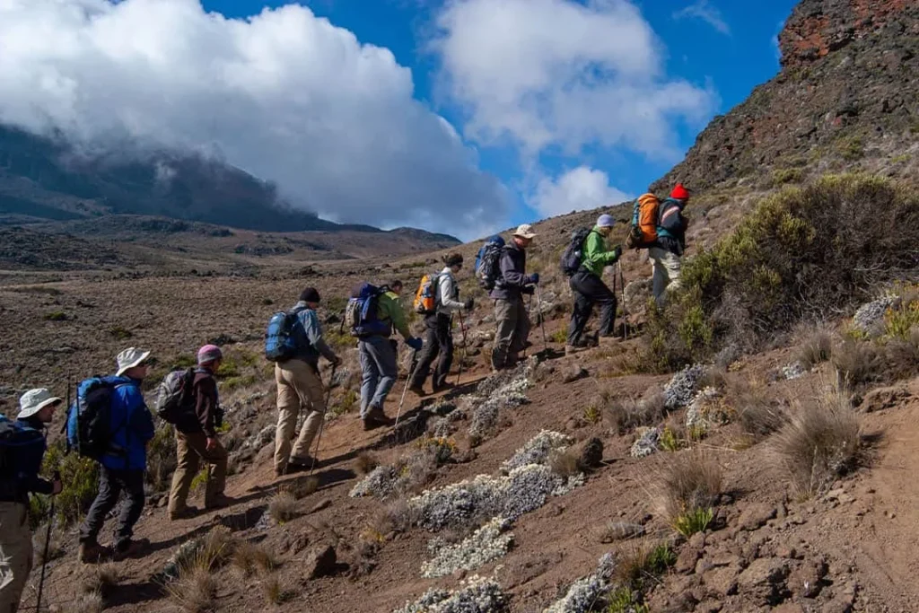
Explore the guide below, then plan your climb with our local team. Share your travel dates and group details for a personalised itinerary.
Request your itineraryTrace the southern forest approach to Shira Cave, the traverse through Barranco and Karanga, and the summit via Barafu.
The ascent starts at Machame Gate. The descent follows Mweka, finishing at a different gate.
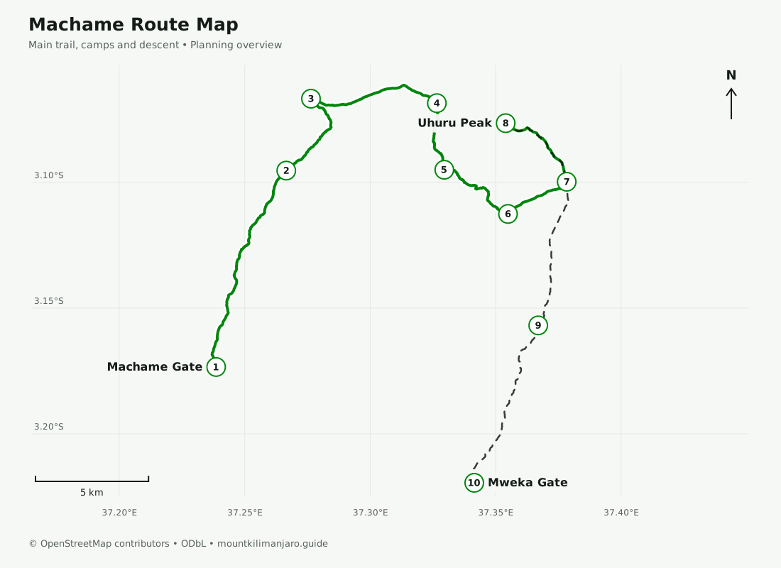
Planning maps, not a navigation service. Trails and approximate camp locations: © OpenStreetMap contributors, ODbL. Distances follow the displayed mapped paths and exclude optional walks. Elevations and walking times are approximate itinerary figures; confirm your final schedule with your guide.
See how the route moves between its main stops. This shows approximate stage elevations, rather than a continuous terrain survey.
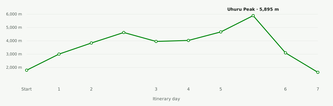
Distances are calculated from the mapped main trail and rounded for planning. Optional acclimatization walks are not included. Walking times follow the published itinerary.
| Day | Trail stage | Mapped distance | Approx. elevations | Walking time |
|---|---|---|---|---|
| Day 1 | Rainforest to Machame CampMachame Gate → Machame Camp | ≈ 10.2 km | 1,800 m → 3,010 m | 5–7 hours |
| Day 2 | Up to the Shira PlateauMachame Camp → Shira Cave Camp | ≈ 4.8 km | 3,010 m → 3,840 m | 4–6 hours |
| Day 3 | Lava Tower to BarrancoShira Cave Camp → Lava Tower → Barranco Camp | ≈ 9.6 km | 3,840 m → 4,630 m → 3,960 m | 6–8 hours |
| Day 4 | Across the Barranco WallBarranco Camp → Karanga Camp | ≈ 4.5 km | 3,960 m → 4,035 m | 4–5 hours |
| Day 5 | The approach to base campKaranga Camp → Barafu Camp | ≈ 3.3 km | 4,035 m → 4,673 m | 3–4 hours |
| Day 6 | Summit and Mweka descentBarafu Camp → Uhuru Peak → Mweka Camp | ≈ 16.1 km | 4,673 m → 5,895 m → 3,100 m | 12–16 hours |
| Day 7 | Forest descent to Mweka GateMweka Camp → Mweka Gate area | ≈ 8.5 km | 3,100 m → 1,640 m | 3–4 hours |
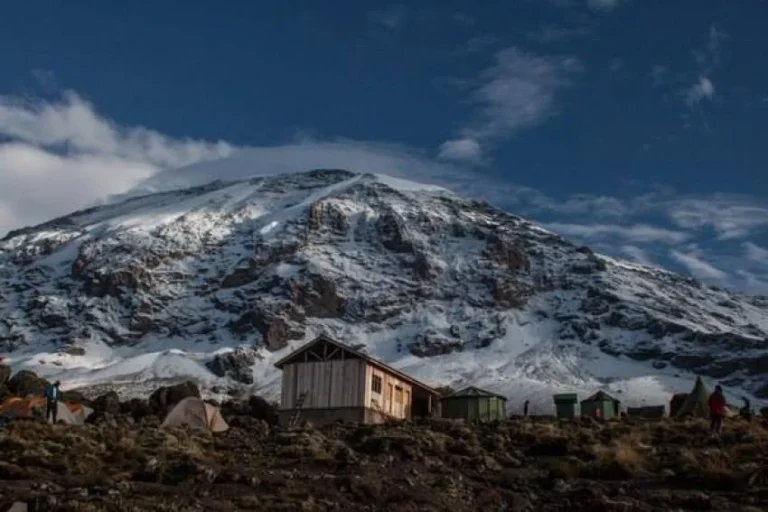
The summit approach continues from Barafu via Stella Point to Uhuru Peak. After the summit, the route returns toward Barafu and turns onto the Mweka descent, finishing at Mweka Gate.
Read the full Machame route guide ↗
Use the map to understand the trail, then explore the full 7-day Machame itinerary with our local team.