Explore the guide below, then plan your climb with our local team. Share your travel dates and group details for a personalised itinerary.
Request your itineraryFind the principal overnight stops used by the four featured routes. Explore the map, then use the camp list to see approximate elevations and the itineraries that visit each location.
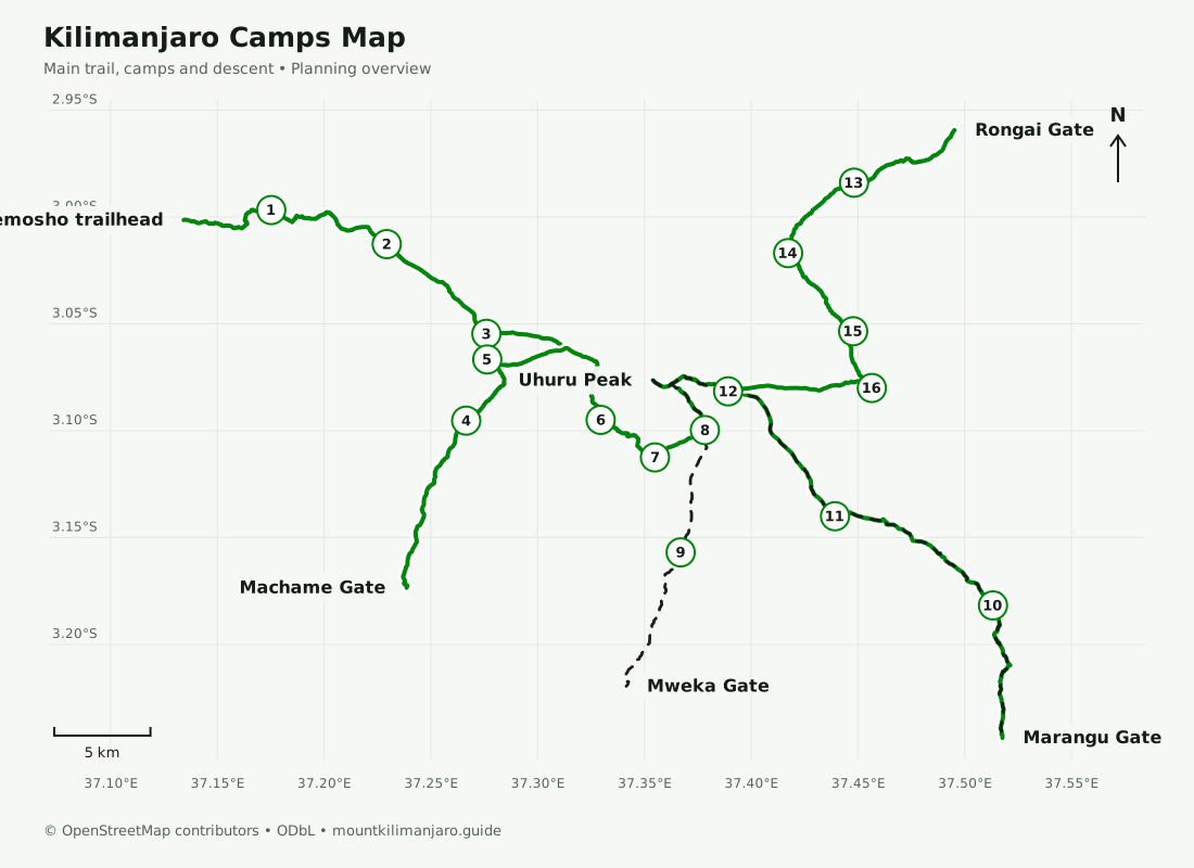
Planning maps, not a navigation service. Trails and approximate camp locations: © OpenStreetMap contributors, ODbL. Distances follow the displayed mapped paths and exclude optional walks. Elevations and walking times are approximate itinerary figures; confirm your final schedule with your guide.
| Camp or hut | Approx. elevation | Featured routes |
|---|---|---|
| Mti Mkubwa Camp | ≈ 2,780 m | Lemosho |
| Shira 1 Camp | ≈ 3,500 m | Lemosho |
| Shira 2 Camp | ≈ 3,900 m | Lemosho |
| Machame Camp | ≈ 3,010 m | Machame |
| Shira Cave Camp | ≈ 3,840 m | Machame |
| Barranco Camp | ≈ 3,960 m | Lemosho, Machame |
| Karanga Camp | ≈ 4,035 m | Lemosho, Machame |
| Barafu Camp | ≈ 4,673 m | Lemosho, Machame |
| Mweka Camp | ≈ 3,100 m | Lemosho, Machame |
| Mandara Huts | ≈ 2,720 m | Marangu, Rongai |
| Horombo Huts | ≈ 3,720 m | Marangu, Rongai |
| Kibo Huts | ≈ 4,700 m | Marangu, Rongai |
| Simba / First Camp | ≈ 2,626 m | Rongai |
| Second Cave Camp | ≈ 3,450 m | Rongai |
| Kikelewa Camp | ≈ 3,600 m | Rongai |
| Mawenzi Tarn Camp | ≈ 4,330 m | Rongai |
Compare the trails, explore the photographs and choose an itinerary with our local team.